Old Maps of Beloit, Wisconsin for Genealogy
Trace your family roots with 37 historic maps of Beloit. These high-res maps reveal old neighborhoods, homesites, landmarks, and streets — helping you uncover where your ancestors lived and how the area evolved over time.
- Explore historic neighborhoods: Identify where your relatives may have lived in the 1800s or 1900s.
- Compare maps over time: Trace the changes in streets, buildings, and landmarks for multi-generational research.
- Perfect for genealogy & ancestry research: Used by family historians and researchers to map out lineage and migration.
These maps are an incredible resource for exploring your personal connection to Beloit's past.
Beloit, WI maps
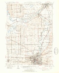
(37)- 1891 Map of Janesville, 1956 Print
 1891 Janesville1956 Print · USGSThe Rock River corridor in the 1890s appears as a burgeoning industrial landscape anchored by the rail hubs of Janesville and Beloit. Genealogists and historians can trace old property sites near Hanover, Afton, and the early settlements of Stevens and Fellows.
 - 1893 Map of Janesville
 1893 Janesville1893 Print · USGSRock County at the close of the nineteenth century is a bustling hub of rail activity and river commerce. Genealogists and local historians can trace the early city footprints of Janesville and Beloit or locate vanished rural stops like Fellows and Stevens.4 unique versions available
 - 1918 Map of Rockford
 1918 Rockford1918 Print · USGSWinnebago County at the end of the Great War reveals a landscape where the river-and-rail economy was in full swing. Genealogists and historians can trace family-named schools like Dickenson School and Eddy School, or locate the Winnebago County Boys Reform School.3 unique versions available
 - 1938 Map of Rockford, 1954 Print
 1938 Rockford1954 Print · USGSWinnebago County at the end of the Depression shows a landscape shaped by river valleys and a dense network of country schoolhouses. You can trace early twentieth-century rural life through landmarks like Holland Spring, the Winnebago County Boys Reform School, and the Rockford and Interurban rail line.3 unique versions available
 - 1954 Map of Rockford
 1954 Rockford1954 Print · USGSThe Rock River valley and the Illinois-Wisconsin borderlands are captured here in the mid-1950s during a period of robust industrial and agricultural activity. Genealogists and historians can trace rail-era corridors like the Illinois Central RR and locate landmarks from Big Foot Prairie to Lake Geneva.
 - 1955 Map of Rockford
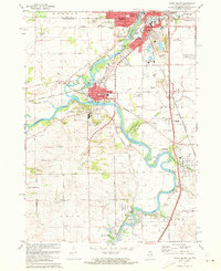
 1955 Rockford1955 Print · USGSThe Rock River valley and southern Wisconsin dairy country are shown here in the mid-fifties as the region's manufacturing centers grew. Genealogists and historians can trace the paths of the Chicago and North Western RR and Illinois Central RR through hubs like Rockford and Beloit.
 - 1958 Map of Rockford, 1974 Print
 1958 Rockford1974 Print · USGSNorthern Illinois and southern Wisconsin are shown here in the mid-twentieth century as rail-dependent industrial towns began to interface with growing lakefront communities. Genealogists can trace family roots through settlements like Saylesville and Tess Corners or locate historical landmarks like the Rockford Ordnance Depot.4 unique versions available
 - 1959 Map of South Beloit, 1960 Print
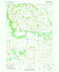
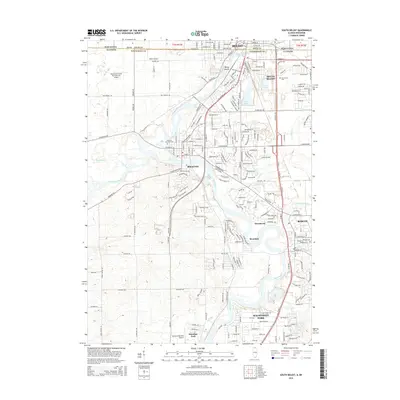
 1959 South Beloit1960 Print · USGSThe Rock River valley at the Illinois-Wisconsin border shows a landscape of growing towns and industrial gravel works in the late fifties. Genealogists can trace rural school locations like Sand Prairie Sch and Lovejoy Sch or the rail lines of the Chicago and North Western.
 - 1962 Map of Newark, 1964 Print
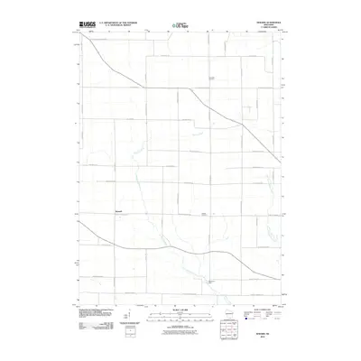
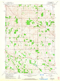 1962 Newark1964 Print · USGSThe rural borderlands of Rock County come to life in the early sixties, showing the agricultural heart of Spring Valley and Newark. Trace family roots through sites like Luther Valley Ch, Maple Grove Cem, and several local schoolhouses.3 unique versions available
 - 1962 Map of Janesville, 1964 Print
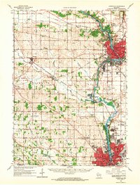 1962 Janesville1964 Print · USGSThe Rock River valley flourished in the early sixties as industrial centers like Janesville and Beloit expanded. Genealogists and local historians can trace rural roots through landmarks like Luther Valley Ch, Newark Cem, and the vanished schoolhouses of Plymouth township.
 - 1962 Map of Beloit, 1972 Print
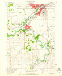
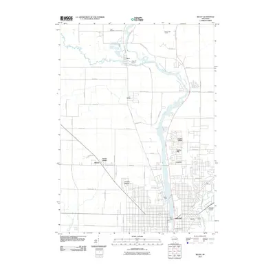
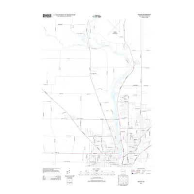
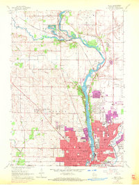 1962 Beloit1972 Print · USGSBeloit and its surrounding river valley were entering a period of suburban expansion in the 1960s and early 1970s. Researchers can trace neighborhood growth near Beloit College or locate family sites at Oakwood Cem and Garden Village.2 unique versions available
 - 1963 Map of Rockford
 1963 Rockford1963 Print · USGSThe mid-century industrial corridor along the Rock River is shown here during a period of rapid post-war growth. Researchers can trace the extensive rail lines of the Chicago and North Western or locate local landmarks like the Rockford Ordnance Depot and Holy Hill.
 - 1971 Map of Shirland, 1973 Print
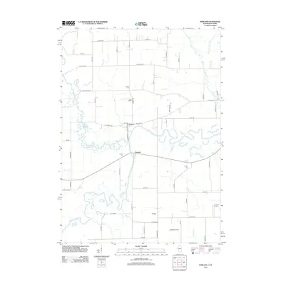
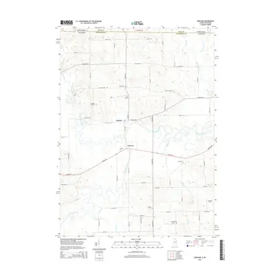
 1971 Shirland1973 Print · USGSWinnebago County near the Wisconsin border was a landscape of river confluences and rural crossroads in the early seventies. Genealogists and local historians can trace the foundations of Shirland and Harrison, alongside landmarks like Phillips Cem and the Boys Farm School.2 unique versions available
 - 1971 Map of South Beloit, 1973 Print
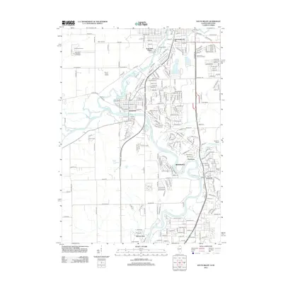
 1971 South Beloit1973 Print · USGSThe Rock River valley on the Illinois-Wisconsin border is captured here in the early 1970s, showing a landscape of industrial river towns and forest preserves. Genealogists and local historians can trace the Floberg Home for Children, Rockton Wagon Wheel Airpark, and the rural Prairie Hill Sch.2 unique versions available
 - 1981 Map of Monroe
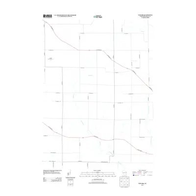
 1981 Monroe1981 Print · USGSSouthern Wisconsin and the Illinois borderlands come into focus in the early 1980s, showcasing a landscape defined by dairy farming and river valleys. Genealogists can trace family roots through historic hubs like Monroe, Stoughton, and Brodhead, or locate regional landmarks such as Yellowstone Lake and the Sugar River.
 - 1981 Map of Rockford
 1981 Rockford1981 Print · USGSNorthern Illinois during the early eighties shows a landscape shaped by river valleys and a maturing rail network. Genealogists can trace family roots through settlements like Morseville and Buckhorn Corners while exploring the Rock River valley.2 unique versions available
 - 1993 Map of South Beloit
 1993 South Beloit1993 Print · USGSNear the state line in the early nineties, this area showcases the evolving riverfront communities of South Beloit and Rockton. Researchers can trace local institutions like the Floberg Home for Children and schools such as Hononegah High Sch.
 - 2010 Map of Newark, 2010 Print
 2010 Newark2010 Print · USGSCovers Beloit, including Town of Newark, Orfordville, and other nearby areas
 - 2010 Map of Beloit, 2010 Print
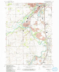
 2010 Beloit2010 Print · USGSCovers Beloit, including Janesville, Turtle, and other nearby areas
 - 2012 Map of Shirland, 2012 Print
 2012 Shirland2012 Print · USGSCovers Beloit, including Shirland, Harrison, and other nearby areas
 - 2012 Map of South Beloit, 2012 Print
 2012 South Beloit2012 Print · USGSCovers Beloit, including Machesney Park, Roscoe, and other nearby areas
 - 2013 Map of Beloit, 2013 Print
 2013 Beloit2013 Print · USGSCovers Beloit, including Janesville, Turtle, and other nearby areas
 - 2013 Map of Newark, 2013 Print
 2013 Newark2013 Print · USGSCovers Beloit, including Town of Newark, Orfordville, and other nearby areas
 - 2015 Map of South Beloit, 2015 Print
 2015 South Beloit2015 Print · USGSCovers Beloit, including Machesney Park, Roscoe, and other nearby areas
 - 2015 Map of Shirland, 2015 Print
 2015 Shirland2015 Print · USGSCovers Beloit, including Shirland, Harrison, and other nearby areas
Showing maps 1-25 of 37
Top cities near Beloit
- Rockford historical maps
- Janesville historical maps
- Beloit historical maps
- Loves Park historical maps
- Machesney Park historical maps
- Roscoe historical maps
See more
Top neighborhoods of Beloit
Frequently asked questions
- What are the different types of historical maps available for Beloit?
- What is the oldest map of Beloit?
- Where can I purchase historical maps of Beloit for my home or office?
- Where can I download high-res historical maps of Beloit?
- Are there historical topographic maps available for Beloit?
- Is there historical aerial imagery available for Beloit?
- Where are historical maps of Beloit sourced from?