Old Maps of Shawano County, Wisconsin for Metal Detecting
Plan your next treasure hunt with 207 historic maps of Shawano County. Find old homesites, ghost towns, trails, and gathering spots that may be lost to time — perfect for identifying promising metal detecting locations.
- Locate forgotten sites: Uncover places like long-lost settlements, abandoned rail lines, or gathering spots.
- Plan better hunts: Use map overlays combined with LiDAR or satellite views to narrow in on historically rich areas.
- Made for detectorists: Thousands of hobbyists use these maps to discover relics, coins, and hidden history.
Use these historic maps to boost your research and find new opportunities beneath the surface of Shawano County.
Shawano County, WI maps
(207)- 1952 Map of Antigo, 1954 Print
 1952 Antigo1954 Print · USGSAntigo and its surrounding townships are shown in detail during the early fifties, capturing a moment of transition for northern Wisconsin's rural school districts. Genealogists can locate family landmarks like the Bohemian Cem, St Johns Ch, and many local schools from Deerbrook to Mattoon.2 unique versions available
 - 1952 Map of White Lake, 1955 Print
 1952 White Lake1955 Print · USGSUpper Wisconsin timberlands and tribal lands meet in the early fifties, showing a region defined by forestry and the Wolf River. You can trace the Chicago and North Western rail line through rural outposts like Sherry Junction, Elton, and Hollister.2 unique versions available
 - 1954 Map of Wittenberg, 1956 Print
 1954 Wittenberg1956 Print · USGSWisconsin’s timber and rail country is captured here during the mid-fifties as many small rural schoolhouses were being phased out. Genealogists and local historians can trace family locations near Forest Home Cem, the settlement of Regina, or the St Johannes Ch.
 - 1954 Map of Gresham, 1956 Print
 1954 Gresham1956 Print · USGSMid-century Shawano County is captured here at a time when the northern timberlands and southern farmsteads met. Genealogists and historians can trace local landmarks like Mohican Sch, the milling center at Neopit, and several rural churches including Immanuel Ch.
 - 1954 Map of Shawano, 1956 Print
 1954 Shawano1956 Print · USGSWisconsin’s northwoods meet the growing city of Shawano in the mid-fifties, centered on the powerful Wolf River and its falls. Genealogists can trace family landmarks like St Jakobi Ch, Red River Cem, and several local schools.
 - 1954 Map of Iron Mountain, 1964 Print
 1954 Iron Mountain1964 Print · USGSUpper Michigan and Northeastern Wisconsin are shown in detail during the mid-fifties, when the logging and mining economies still moved by rail. Trace the rail lines of the Soo Line to remote stops like Koepenick Station or explore the Iron Range near Iron Mountain.2 unique versions available
 - 1954 Map of Green Bay, 1980 Print
 1954 Green Bay1980 Print · USGSGreen Bay and Brown County are shown during a period of steady mid-century growth and agricultural prominence. Researchers can trace family roots through numerous country schools like White Pine Sch and established cemeteries such as Chase Cem and Peace Cem.
 - 1955 Map of Embarrass, 1957 Print
 1955 Embarrass1957 Print · USGSIn the mid-1950s, this pocket of Wisconsin was a landscape of dairy townships and evolving rural education. Genealogists can trace family roots through numerous sites like St John Ch, the Danish Cem, and many schoolhouses marked abandoned including Riverbank Sch.2 unique versions available
 - 1955 Map of Clintonville, 1957 Print
 1955 Clintonville1957 Print · USGSClintonville and Marion are shown at a peak of rail-era development in the mid-1950s. Genealogists can trace family roots through numerous rural landmarks like Graceland Cem, the Danish Cem, and one-room schoolhouses such as Sunrise Sch.2 unique versions available
 - 1955 Map of Tigerton, 1957 Print
 1955 Tigerton1957 Print · USGSThe rural borderlands of Shawano and Waupaca Counties come alive in the mid-1950s, showing a landscape of small schools and river-fed mill towns. Genealogists can trace family landmarks like Alban Chapel, the Hitterdahl Ch, and old rural schoolhouses including Selmer Sch.2 unique versions available
 - 1955 Map of Seymour, 1957 Print
 1955 Seymour1957 Print · USGSWisconsin's dairy heartland comes alive in this mid-century survey of the borderlands between Shawano and Outagamie counties. Genealogists can trace family roots through numerous rural schools and churches, from St Johns Ch to the Elm Grove Cem near Laney.3 unique versions available
 - 1955 Map of Green Bay, 1968 Print
 1955 Green Bay1968 Print · USGSCentral and Eastern Wisconsin are captured here in the mid-fifties, showing the industrial growth of the Fox Valley and Wisconsin River corridors. Genealogists and historians can trace rail lines like the Green Bay and Western through settlements like Weyauwega, Clintonville, and Pulaski.2 unique versions available
 - 1956 Map of Gillett, 1957 Print
 1956 Gillett1957 Print · USGSIn the mid-fifties, the Oconto County countryside was defined by a dense network of one-room schoolhouses and the Chicago and North Western rail line. Genealogists can trace family roots through sites like Puleifer Cem or the Valley Line Sch (Abandoned).
 - 1956 Map of Oconto Falls, 1958 Print
 1956 Oconto Falls1958 Print · USGSOconto County in the mid-fifties is captured here as a landscape of rural school districts and river-based industry. Genealogists can locate family-named landmarks like Dombrowski Lake and Kuplie Lake, or trace rail history at Stiles Junction.3 unique versions available
 - 1959 Map of Iron Mountain
 1959 Iron Mountain1959 Print · USGSThe northwoods of Wisconsin and the Michigan border are captured here in the mid-fifties, showing a landscape defined by timber, water, and rail. Researchers can trace historic junctions like Hiles Junction, the expansive Nicolet National Forest, and lakefront settlements from Rhinelander to Tomahawk.2 unique versions available
 - 1964 Map of Wittenberg, 1965 Print
 1964 Wittenberg1965 Print · USGSSettled along the border of Marathon and Shawano counties in the 1960s, this area shows a landscape shaped by timber and rail. Researchers can trace local lineage through several sites like Homme Home for Boys, St Philomena Ch, and Holy Family Cem.2 unique versions available
 - 1964 Map of Shawano, 1965 Print
 1964 Shawano1965 Print · USGSThe Menominee Indian Reservation and the growing city of Shawano are shown here in the mid-1960s as the Wolf River winds south. Genealogists and historians can trace local landmarks like the Alexian Brothers Novitiate, Keshena School, and the West Branch Cemetery.2 unique versions available
 - 1964 Map of Gresham, 1975 Print
 1964 Gresham1975 Print · USGSMid-century Shawano County is mapped here during a period of transition for its northern timberlands and southern farms. Genealogists and researchers can trace family names through rural landmarks like Hermanfort Sch, St Marys Cem, and Tilleda.
 - 1969 Map of Leeman, 1971 Print
 1969 Leeman1971 Print · USGSOutagamie and Shawano counties are captured here in the late sixties, where the winding Wolf River meets vast conservation lands. Researchers can locate family landmarks along Eskman Road, the St Lawrence Cem, and the old Navarino Sch.
 - 1969 Map of Embarrass, 1971 Print
 1969 Embarrass1971 Print · USGSWisconsin's river-and-lake country comes alive in the late sixties as the Embarrass River winds past small farming communities and lakeside retreats. Trace local history at St Peter Cem, the village of Embarrass, and the shoreline developments of Adams Beach.2 unique versions available
 - 1969 Map of Lunds, 1971 Print
 1969 Lunds1971 Print · USGSWisconsin's river-fed wetlands and rural townships are captured here in the late sixties as the Wolf River snakes through the Navarino Wildlife Area. Local historians can trace family roots at Hilda Cem or locate community centers like St Wenceslaus Ch and the settlement of Lunds.
 - 1970 Map of Tigerton NW, 1973 Print
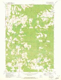 1970 Tigerton NW1973 Print · USGSNorth-central Wisconsin in the 1970s shows a landscape of dense water networks and forest land where four counties meet. Researchers can trace the OLD RAILROAD GRADE near Jackson Lake or locate the rural hub of Norske and its surrounding family-named roads.2 unique versions available
 - 1970 Map of Clintonville North, 1973 Print
 1970 Clintonville North1973 Print · USGSThe rural borderlands of Shawano and Waupaca Counties come alive in the early seventies, centered on the village of Pella and the winding Embarrass River. Genealogists can trace family footprints along Magolski Road or near historic sites like Bethlehem Ch Cem and Immanuel Ch.
 - 1970 Map of Marion, 1973 Print
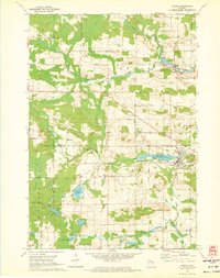 1970 Marion1973 Print · USGSThe river valleys of Waupaca and Shawano counties are captured here in the early seventies, centered on the rail hub of Marion. Researchers can trace local genealogy through several rural burial grounds including Zion Cem, Roseland Cem, and Greenleaf Cem.2 unique versions available
 - 1970 Map of Tigerton, 1973 Print
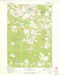 1970 Tigerton1973 Print · USGSWisconsin timber and rail country come into focus in the early seventies, centered on the village of Tigerton and its river-bend economy. Researchers can trace family homesteads along Laars Road, locate the Tigerton Lookout Tower, and follow the historic Chicago and North Western line.2 unique versions available
Showing maps 1-25 of 207
Top cities of Shawano County
- Shawano historical maps
- Belle Plaine historical maps
- Angelica historical maps
- Bonduel historical maps
- Wittenberg historical maps
- Wittenberg historical maps
See more
Frequently asked questions
- What are the different types of historical maps available for Shawano County?
- What is the oldest map of Shawano County?
- Where can I purchase historical maps of Shawano County for my home or office?
- Where can I download high-res historical maps of Shawano County?
- Are there historical topographic maps available for Shawano County?
- Is there historical aerial imagery available for Shawano County?
- Where are historical maps of Shawano County sourced from?