Old Maps of Hale, Wisconsin for Metal Detecting
Plan your next treasure hunt with 26 historic maps of Hale. Find old homesites, ghost towns, trails, and gathering spots that may be lost to time — perfect for identifying promising metal detecting locations.
- Locate forgotten sites: Uncover places like long-lost settlements, abandoned rail lines, or gathering spots.
- Plan better hunts: Use map overlays combined with LiDAR or satellite views to narrow in on historically rich areas.
- Made for detectorists: Thousands of hobbyists use these maps to discover relics, coins, and hidden history.
Use these historic maps to boost your research and find new opportunities beneath the surface of Hale.
Hale, WI maps
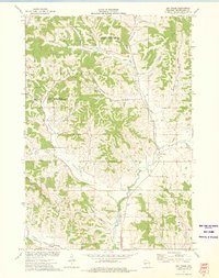
(26)- 1926 Map of Whitehall, 1972 Print
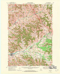
 1926 Whitehall1972 Print · USGSTrempealeau County is captured here in the mid-twenties, a landscape of coulees and river valleys shaped by the Green Bay and Western Railroad. Genealogists can locate dozens of country schools and homestead-named landmarks like Chimney Rock or the Trempealeau County Asylum.
 - 1927 Map of Blair
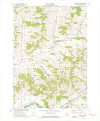
 1927 Blair1927 Print · USGSIn the 1920s, the coulee country of Trempealeau and Jackson Counties was a landscape of tightly-knit valley settlements and rural schools. Genealogists can trace family footprints through numerous local landmarks like Schermerhorn School, Pigeon Falls, and Fly Creek School.2 unique versions available
 - 1927 Map of Strum, 1972 Print
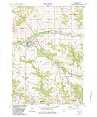
 1927 Strum1972 Print · USGSWisconsin's coulee country in the late 1920s is captured here, showing the river-and-rail economies of the Buffalo River valley. Genealogists can locate dozens of country schoolhouses like Hale Corner Sch and family-named landmarks such as Hadleyville Cem.
 - 1929 Map of Whitehall
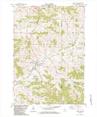
 1929 Whitehall1929 Print · USGSTrempealeau County during the late twenties is shown here as a dense network of coulees and river-bottom settlements. Researchers can trace early railroad history along the Green Bay and Western RR and locate many rural landmarks including the County Asylum and Brookside Sch.2 unique versions available
 - 1930 Map of Strum
 1930 Strum1930 Print · USGSWestern Wisconsin's river valleys and rail corridors are captured here just before the 1930s. Researchers can trace the lineage of rural townships like Washington and Unity through a network of country schools and churches, including St Paul Ch and Big Creek Sch.2 unique versions available
 - 1935 Map of Osseo
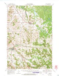
 1935 Osseo1935 Print · USGSOsseo and Augusta were busy railway and river hubs in the mid-1930s, where the rural landscape was tied together by dozens of local schools and the Chicago and Northwestern. Genealogists can trace family footprints at Bear Grass Cem and vanished rural landmarks like Rodell Spur and Troubled Waters Sch.
 - 1940 Map of Osseo
 1940 Osseo1940 Print · USGSOsseo and Augusta anchored this river-carved landscape of west-central Wisconsin in the years surrounding the Great Depression. Researchers can trace the heritage of rural neighborhoods through several dozen district schools, including Troubled Waters Sch, Yule Sch, and Churchview Sch.
 - 1953 Map of Eau Claire, 1965 Print
 1953 Eau Claire1965 Print · USGSWest-central Wisconsin in the mid-fifties shows a landscape of river-valley industry and vast wildlife refuges during the transition from rails to modern highways. Genealogists and historians can trace the rail corridors of the Chicago and North Western or locate family-named landmarks like Decorah Mound and Chippewa Island.4 unique versions available
 - 1958 Map of Eau Claire
 1958 Eau Claire1958 Print · USGSWestern Wisconsin in the late fifties shows a landscape of growing regional hubs and massive wildlife refuges. Trace the rail lines of the Chicago and North Western between Eau Claire and Marshfield, or explore the terrain around Iron Mound and Lake Wissota.
 - 1964 Map of Eau Claire
 1964 Eau Claire1964 Print · USGSWest-central Wisconsin in the mid-1960s was a hub of river-driven industry and expanding rail networks. Researchers can trace historic homesteads near Menomonie, follow the Soo Line RR through Marshfield, or explore the grounds of the Camp McCoy Military Reservation.
 - 1968 Map of Blair, 1971 Print
 1968 Blair1971 Print · USGSWisconsin's coulee country comes into focus in the late sixties, showing the vital rail-and-river corridor between Blair and Hixton. Researchers can locate the Amish Sch, trace the Green Bay and Western line, and find family names near French Creek Cem.2 unique versions available
 - 1968 Map of Osseo, 1971 Print
 1968 Osseo1971 Print · USGSOsseo and Augusta appear in the late sixties as vital hubs for the Chicago and North Western rail line and regional farming. Researchers can locate historic rural congregations and resting places like St Peters Ch and Thompson Valley Cem amidst a network of small dairy-country valleys.
 - 1973 Map of Strum SE, 1975 Print
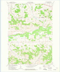 1973 Strum SE1975 Print · USGSTrempealeau County in the early seventies is shown here as a landscape of interconnected river valleys and rural townships. Researchers can trace the Chicago and North Western rail line and locate local landmarks like West Beef River Cem and Viking Airfield.
 - 1973 Map of Strum, 1975 Print
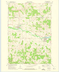 1973 Strum1975 Print · USGSTrempealeau County farm and rail life are centered here in the early seventies, as the river valley connects active village centers. Genealogists and historians can trace local landmarks like Hamlin Cem, the Central Area High Sch, and the winding Chicago and North Western rail line.
 - 1973 Map of Elk Creek, 1975 Print
 1973 Elk Creek1975 Print · USGSTrempealeau County's rural coulee country is captured in the early seventies, showing a landscape defined by deep valleys and high ridges. Researchers can locate family-named landmarks like Walek Knob and burial sites such as Chimney Rock Cem and Cripps Cem.
 - 1973 Map of Pleasantville, 1975 Print
 1973 Pleasantville1975 Print · USGSThe coulee country of Trempealeau County is captured here in the early seventies, showcasing a rural landscape of valley farms and ridge-top quarries. Researchers can locate family landmarks like the Wagner Cem, Elk Creek Ch, and the small settlement of Coral City.
 - 1984 Map of Osseo
 1984 Osseo1984 Print · USGSOsseo and the surrounding Wisconsin countryside are documented here in the mid-1980s as the regional hub for agricultural and river life. Genealogists and local historians can trace family locations near King Valley Ch, the South Valley Cem, and the small settlement of Requa.
 - 1984 Map of Pigeon Falls
 1984 Pigeon Falls1984 Print · USGSMid-1980s Trempealeau County comes alive in this survey of the coulee country surrounding the village of Pigeon Falls. Genealogists and local historians can trace family-named valleys like Hegge Coulee and locate rural landmarks such as Hale Cem and York.
 - 1985 Map of Eau Claire
 1985 Eau Claire1985 Print · USGSWestern Wisconsin's river valleys and growing mid-century cities are captured here in the mid-eighties. Genealogists and historians can trace the paths of the Chicago and North Western railroad and locate rural landmarks like Dells Millpond and Nine Mile Island.2 unique versions available
 - 1985 Map of Winona
 1985 Winona1985 Print · USGSThe Mississippi River valley and the coulees of the Driftless Area are shown here in the mid-1980s as the river's lock-and-dam system was well-established. Researchers can trace the riverfront at Winona, explore the bluffs near Galesville, or locate landmarks like Sugarloaf and Merrick State Park.2 unique versions available
 - 2022 Map of Elk Creek, 2022 Print
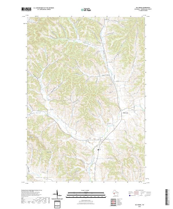 2022 Elk Creek2022 Print · USGSTrempealeau County's rural coulee country remains centered around the small community of Elk Creek in this modern survey. Genealogists and local historians can trace family-named landmarks like Walek Knob and find the location of the Cripps Cem.
 - 2022 Map of Pigeon Falls, 2022 Print
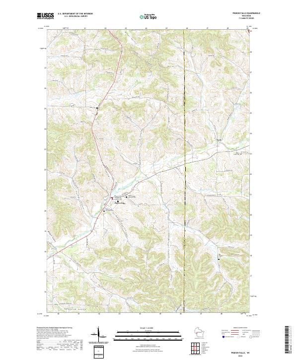 2022 Pigeon Falls2022 Print · USGSWestern Wisconsin's coulee country is captured here in recent years, showing the traditional farming landscapes around Pigeon Falls. Researchers can trace old family names and local history through landmarks like Pigeon Creek Lutheran Cem, York, and Kings Valley.
 - 2022 Map of Pleasantville, 2022 Print
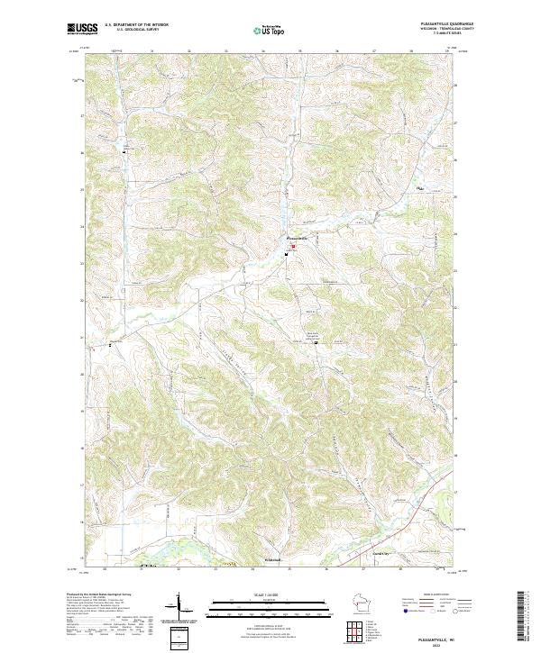 2022 Pleasantville2022 Print · USGSThe rural coulee country of Trempealeau County is captured here in the early 2020s, showing a landscape shaped by narrow valleys and winding creeks. Genealogists can locate family landmarks like Bruce Valley Cem and Wagner Cem or trace the early settlements of Pleasantville and Coral City.
 - 2022 Map of Strum, 2022 Print
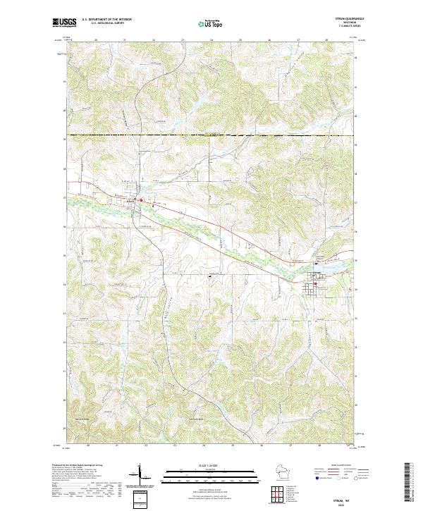 2022 Strum2022 Print · USGSThe Buffalo River valley comes into focus in this contemporary survey of Trempealeau and Eau Claire counties. Researchers can trace landownership patterns through family-named landmarks like Bennett Ridge and Anderson Valley or locate local burials at Hamlin Cem.
 - 2022 Map of Osseo, 2022 Print
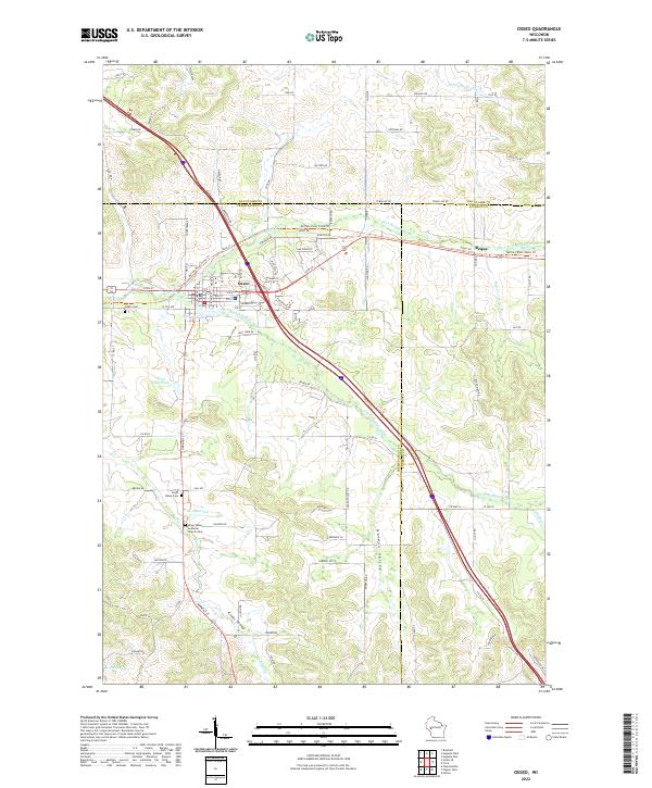 2022 Osseo2022 Print · USGSOsseo sits at the confluence of the Buffalo River forks in the early 2020s, anchoring a landscape of deep coulees and valley farms. Genealogists can locate family sites at Kings Valley Lutheran Church Cem or trace the old rail grade now known as the Buffalo River State Trl.
Showing maps 1-25 of 26
Top cities near Hale
- Arcadia historical maps
- Pleasant Valley historical maps
- Osseo historical maps
- Whitehall historical maps
- Independence historical maps
- Augusta historical maps
See more
Top neighborhoods of Hale
Frequently asked questions
- What are the different types of historical maps available for Hale?
- What is the oldest map of Hale?
- Where can I purchase historical maps of Hale for my home or office?
- Where can I download high-res historical maps of Hale?
- Are there historical topographic maps available for Hale?
- Is there historical aerial imagery available for Hale?
- Where are historical maps of Hale sourced from?