Old Maps of Pigeon, Wisconsin
Explore 32 old maps of Pigeon, spanning from 1926 to today. These high-resolution historic maps reveal how streets, neighborhoods, landmarks, and natural features evolved over time — perfect for genealogy, metal detecting, research, and local history exploration.
What you can do with these maps:
- See how Pigeon changed over time: Compare historical maps to modern-day views to trace roads, homesites, rail lines & more.
- View detailed metadata: Each map includes creators, publishers, year, scale, and archive source.
- Overlay maps with satellite & LiDAR: Visualize the past alongside modern tools to explore terrain & human change.
- Trusted historical sources: Maps sourced from the USGS, Library of Congress, and other archives.
- Access maps your way: View online, download high-res files, or order prints for personal or research use.
Start exploring old maps of Pigeon to uncover forgotten places, hidden landmarks, and the deep history beneath your feet.
Pigeon, WI maps
(32)- 1926 Map of Whitehall, 1972 Print
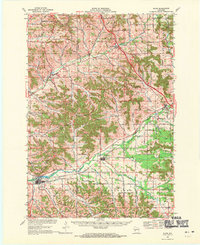
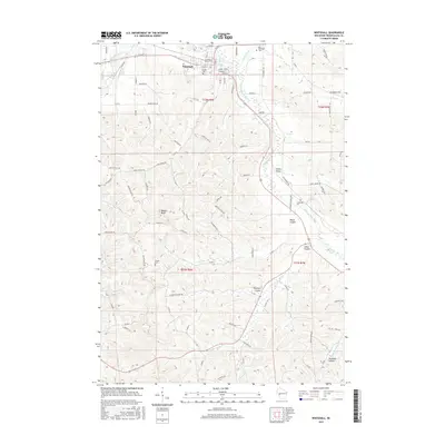
 1926 Whitehall1972 Print · USGSTrempealeau County is captured here in the mid-twenties, a landscape of coulees and river valleys shaped by the Green Bay and Western Railroad. Genealogists can locate dozens of country schools and homestead-named landmarks like Chimney Rock or the Trempealeau County Asylum.
 - 1927 Map of Blair
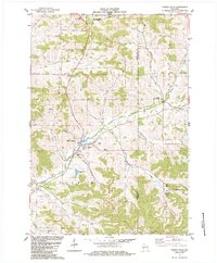
 1927 Blair1927 Print · USGSIn the 1920s, the coulee country of Trempealeau and Jackson Counties was a landscape of tightly-knit valley settlements and rural schools. Genealogists can trace family footprints through numerous local landmarks like Schermerhorn School, Pigeon Falls, and Fly Creek School.2 unique versions available
 - 1929 Map of Whitehall
 1929 Whitehall1929 Print · USGSTrempealeau County during the late twenties is shown here as a dense network of coulees and river-bottom settlements. Researchers can trace early railroad history along the Green Bay and Western RR and locate many rural landmarks including the County Asylum and Brookside Sch.2 unique versions available
 - 1953 Map of Eau Claire, 1965 Print
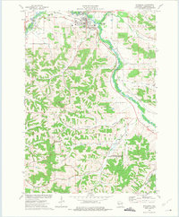
 1953 Eau Claire1965 Print · USGSWest-central Wisconsin in the mid-fifties shows a landscape of river-valley industry and vast wildlife refuges during the transition from rails to modern highways. Genealogists and historians can trace the rail corridors of the Chicago and North Western or locate family-named landmarks like Decorah Mound and Chippewa Island.4 unique versions available
 - 1958 Map of Eau Claire
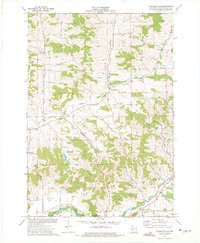
 1958 Eau Claire1958 Print · USGSWestern Wisconsin in the late fifties shows a landscape of growing regional hubs and massive wildlife refuges. Trace the rail lines of the Chicago and North Western between Eau Claire and Marshfield, or explore the terrain around Iron Mound and Lake Wissota.
 - 1964 Map of Eau Claire
 1964 Eau Claire1964 Print · USGSWest-central Wisconsin in the mid-1960s was a hub of river-driven industry and expanding rail networks. Researchers can trace historic homesteads near Menomonie, follow the Soo Line RR through Marshfield, or explore the grounds of the Camp McCoy Military Reservation.
 - 1968 Map of Blair, 1971 Print
 1968 Blair1971 Print · USGSWisconsin's coulee country comes into focus in the late sixties, showing the vital rail-and-river corridor between Blair and Hixton. Researchers can locate the Amish Sch, trace the Green Bay and Western line, and find family names near French Creek Cem.2 unique versions available
 - 1973 Map of Whitehall, 1975 Print
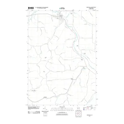
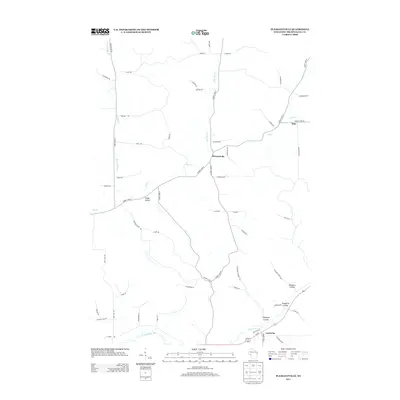
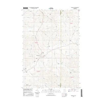
 1973 Whitehall1975 Print · USGSWhitehall and the Trempealeau River valley in the early 1970s reveal a landscape of deep coulees and ridge-top farms. Genealogists can trace family footprints at Old Whitehall Cem, Fagernes Ch, and the small settlement of Larkin.
 - 1973 Map of Pleasantville, 1975 Print
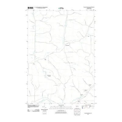
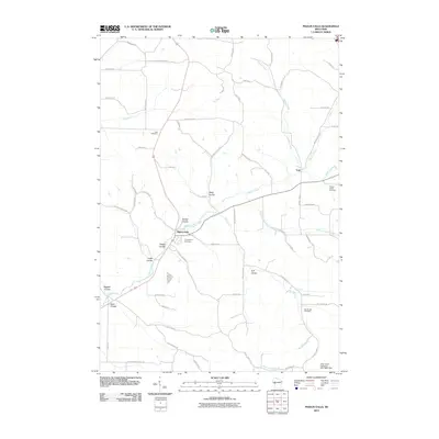
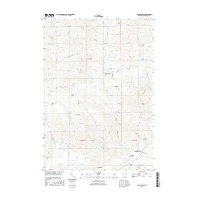
 1973 Pleasantville1975 Print · USGSThe coulee country of Trempealeau County is captured here in the early seventies, showcasing a rural landscape of valley farms and ridge-top quarries. Researchers can locate family landmarks like the Wagner Cem, Elk Creek Ch, and the small settlement of Coral City.
 - 1984 Map of Blair
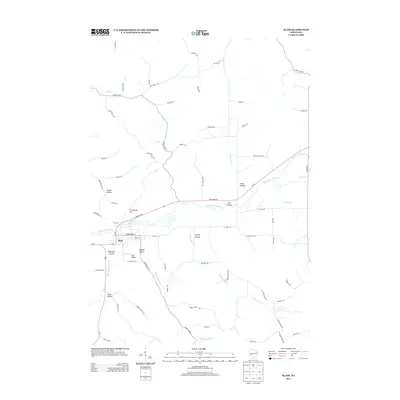
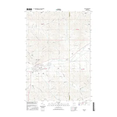
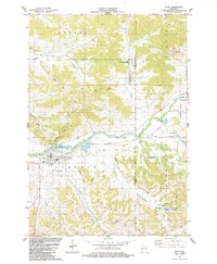 1984 Blair1984 Print · USGSThe coulee country of Trempealeau and Jackson Counties is captured here in the mid-1980s as the Trempealeau River flows through Blair. Genealogists and local historians can trace rural landmarks like Zion Cem, the Pine Hill Sch, and the Trump Coulee Cem.
 - 1984 Map of Pigeon Falls
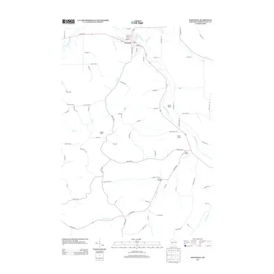
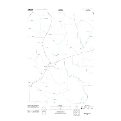
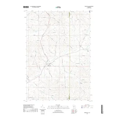
 1984 Pigeon Falls1984 Print · USGSMid-1980s Trempealeau County comes alive in this survey of the coulee country surrounding the village of Pigeon Falls. Genealogists and local historians can trace family-named valleys like Hegge Coulee and locate rural landmarks such as Hale Cem and York.
 - 1985 Map of Winona
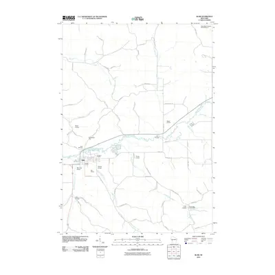
 1985 Winona1985 Print · USGSThe Mississippi River valley and the coulees of the Driftless Area are shown here in the mid-1980s as the river's lock-and-dam system was well-established. Researchers can trace the riverfront at Winona, explore the bluffs near Galesville, or locate landmarks like Sugarloaf and Merrick State Park.2 unique versions available
 - 2010 Map of Pleasantville, 2010 Print
 2010 Pleasantville2010 Print · USGSCovers Pigeon, including Whitehall, Hale, and other nearby areas
 - 2010 Map of Blair, 2010 Print
 2010 Blair2010 Print · USGSCovers Pigeon, including Blair, Taylor, and other nearby areas
 - 2010 Map of Whitehall, 2010 Print
 2010 Whitehall2010 Print · USGSCovers Pigeon, including Whitehall, Arcadia, and other nearby areas
 - 2010 Map of Pigeon Falls, 2010 Print
 2010 Pigeon Falls2010 Print · USGSCovers Pigeon, including Hale, Northfield, and other nearby areas
 - 2013 Map of Pleasantville, 2013 Print
 2013 Pleasantville2013 Print · USGSCovers Pigeon, including Whitehall, Hale, and other nearby areas
 - 2013 Map of Blair, 2013 Print
 2013 Blair2013 Print · USGSCovers Pigeon, including Blair, Taylor, and other nearby areas
 - 2013 Map of Whitehall, 2013 Print
 2013 Whitehall2013 Print · USGSCovers Pigeon, including Whitehall, Arcadia, and other nearby areas
 - 2013 Map of Pigeon Falls, 2013 Print
 2013 Pigeon Falls2013 Print · USGSCovers Pigeon, including Hale, Northfield, and other nearby areas
 - 2015 Map of Whitehall, 2015 Print
 2015 Whitehall2015 Print · USGSCovers Pigeon, including Whitehall, Arcadia, and other nearby areas
 - 2015 Map of Pigeon Falls, 2015 Print
 2015 Pigeon Falls2015 Print · USGSCovers Pigeon, including Hale, Northfield, and other nearby areas
 - 2015 Map of Blair, 2015 Print
 2015 Blair2015 Print · USGSCovers Pigeon, including Blair, Taylor, and other nearby areas
 - 2015 Map of Pleasantville, 2015 Print
 2015 Pleasantville2015 Print · USGSCovers Pigeon, including Whitehall, Hale, and other nearby areas
 - 2018 Map of Pigeon Falls, 2018 Print
 2018 Pigeon Falls2018 Print · USGSCovers Pigeon, including Hale, Northfield, and other nearby areas
Showing maps 1-25 of 32
Top cities near Pigeon
- Pleasant Valley historical maps
- Osseo historical maps
- Whitehall historical maps
- Independence historical maps
- Blair historical maps
- Strum historical maps
See more
Top neighborhoods of Pigeon
Frequently asked questions
- What are the different types of historical maps available for Pigeon?
- What is the oldest map of Pigeon?
- Where can I purchase historical maps of Pigeon for my home or office?
- Where can I download high-res historical maps of Pigeon?
- Are there historical topographic maps available for Pigeon?
- Is there historical aerial imagery available for Pigeon?
- Where are historical maps of Pigeon sourced from?