2020s Maps of Pigeon, Wisconsin
Explore 4 historic maps of Pigeon from the 2020s. These maps offer a rare glimpse into what life looked like during the 2020s — showing old roads, neighborhoods, homes, and landmarks that have changed or disappeared over time.
Whether you're researching your family's past, planning a metal detecting trip, or studying how Pigeon's landscape evolved across the 2020s, these high-resolution maps are a powerful tool for exploring the history of this region.
- Focus on a specific era: All maps on this page are from the 2020s, giving you a focused view of this time period.
- See what’s changed: Compare century-old streets, trails, and buildings to today's modern landscape using overlays and satellite layers.
- Research with precision: Use these maps for genealogy, historical research, land use analysis, or educational projects.
- View, download, or print: Maps are fully viewable online in high resolution, and can be downloaded or printed for your own records.
Start exploring Pigeon's history through authentic maps from the 2020s. This is your window into the past.
Pigeon, WI maps
(4)- 2022 Map of Pigeon Falls, 2022 Print
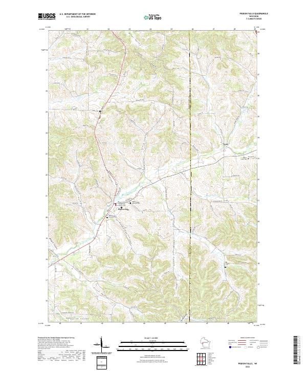 2022 Pigeon Falls2022 Print · USGSWestern Wisconsin's coulee country is captured here in recent years, showing the traditional farming landscapes around Pigeon Falls. Researchers can trace old family names and local history through landmarks like Pigeon Creek Lutheran Cem, York, and Kings Valley.
 - 2022 Map of Pleasantville, 2022 Print
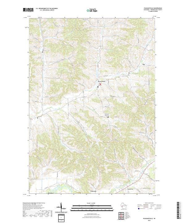 2022 Pleasantville2022 Print · USGSThe rural coulee country of Trempealeau County is captured here in the early 2020s, showing a landscape shaped by narrow valleys and winding creeks. Genealogists can locate family landmarks like Bruce Valley Cem and Wagner Cem or trace the early settlements of Pleasantville and Coral City.
 - 2022 Map of Blair, 2022 Print
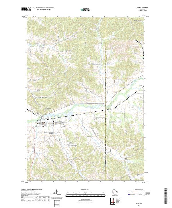 2022 Blair2022 Print · USGSThe Trempealeau River valley in the early 2020s remains defined by its deep coulees and established communities. Researchers can trace family sites at Zion Lutheran Cem and Rest Haven Cem, or explore the terrain around Gransberg Hill and Trump Coulee.
 - 2022 Map of Whitehall, 2022 Print
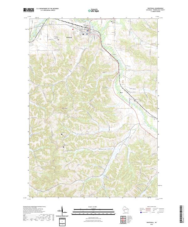 2022 Whitehall2022 Print · USGSWhitehall and the Trempealeau River valley are shown here in the early 2020s, highlighting the unique coulee and ridge terrain of western Wisconsin. Researchers can trace historic farmstead roads and locate several cemeteries including Tinnes Cem and the Old Whitehall Cem.
End of results
Showing maps 1-4 of 4
Top cities near Pigeon
- Pleasant Valley historical maps
- Osseo historical maps
- Whitehall historical maps
- Independence historical maps
- Blair historical maps
- Strum historical maps
See more
Top neighborhoods of Pigeon
Frequently asked questions
- What are the different types of historical maps available for Pigeon?
- What is the oldest map of Pigeon?
- Where can I purchase historical maps of Pigeon for my home or office?
- Where can I download high-res historical maps of Pigeon?
- Are there historical topographic maps available for Pigeon?
- Is there historical aerial imagery available for Pigeon?
- Where are historical maps of Pigeon sourced from?