2020s Maps of Greenwood, Wisconsin
Explore 4 historic maps of Greenwood from the 2020s. These maps offer a rare glimpse into what life looked like during the 2020s — showing old roads, neighborhoods, homes, and landmarks that have changed or disappeared over time.
Whether you're researching your family's past, planning a metal detecting trip, or studying how Greenwood's landscape evolved across the 2020s, these high-resolution maps are a powerful tool for exploring the history of this region.
- Focus on a specific era: All maps on this page are from the 2020s, giving you a focused view of this time period.
- See what’s changed: Compare century-old streets, trails, and buildings to today's modern landscape using overlays and satellite layers.
- Research with precision: Use these maps for genealogy, historical research, land use analysis, or educational projects.
- View, download, or print: Maps are fully viewable online in high resolution, and can be downloaded or printed for your own records.
Start exploring Greenwood's history through authentic maps from the 2020s. This is your window into the past.
Greenwood, WI maps
(4)- 2022 Map of Trippville, 2022 Print
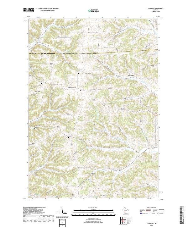 2022 Trippville2022 Print · USGSThe driftless uplands near Mount Tabor and Trippville are captured in this modern survey. Genealogists can locate family burial sites at Saint Joseph Cem or Bohemian Brotherhood Cem and trace old routes through Newman Valley and Barton Hollow.
 - 2022 Map of Valton, 2022 Print
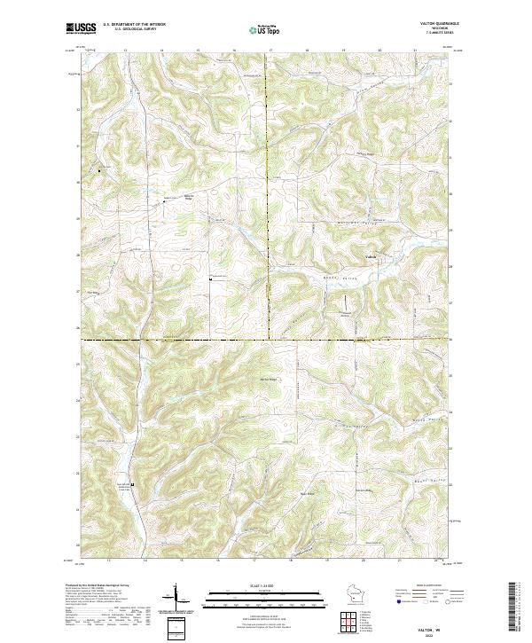 2022 Valton2022 Print · USGSRichland and Sauk County's complex ridge-and-valley landscape is documented here in the early twenty-first century. Researchers can locate secluded family burial grounds like Debello Cem and trace the paths of the Little Baraboo River and Melancthon Cr.
 - 2022 Map of Hillsboro, 2022 Print
 2022 Hillsboro2022 Print · USGSThe valleys and bluffs of Vernon and Juneau counties are captured here in the early twenty-first century. Genealogists and hikers can trace sites like Mount Vernon Cem and the Hillsboro State Trl through Hillsboro and Union Center.
 - 2022 Map of Yuba, 2022 Print
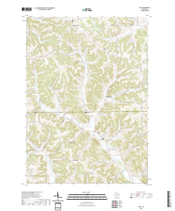 2022 Yuba2022 Print · USGSRichland and Vernon Counties are captured here in the early 2020s, showing the enduring rural character of the Wisconsin Driftless Area. Local historians can trace family roots through the Czechs National Cem or explore the landscape around Yuba and Happy Hollow.
End of results
Showing maps 1-4 of 4
Top cities near Greenwood
- Elroy historical maps
- Hillsboro historical maps
- Wonewoc historical maps
- Rockbridge historical maps
- Lindina historical maps
- Clifton historical maps
See more
Frequently asked questions
- What are the different types of historical maps available for Greenwood?
- What is the oldest map of Greenwood?
- Where can I purchase historical maps of Greenwood for my home or office?
- Where can I download high-res historical maps of Greenwood?
- Are there historical topographic maps available for Greenwood?
- Is there historical aerial imagery available for Greenwood?
- Where are historical maps of Greenwood sourced from?