Old Maps of Addison, Wisconsin for Hiking & Exploration
Hike through history with 14 historic maps of Addison. Explore old trails, ghost towns, and forgotten backroads — perfect for outdoor adventurers and local explorers.
- Rediscover forgotten places: Map out old mining camps, roads, and footpaths that no longer exist on modern maps.
- Layer with modern tools: Combine with LiDAR or satellite views to plan hikes through historical terrain.
- Made for exploration: Popular among hikers, overlanders, and local history lovers.
Use these maps to find adventure and explore the hidden past of Addison.
Addison, WI maps
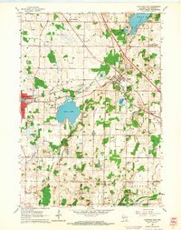
(14)- 1904 Map of Hartford
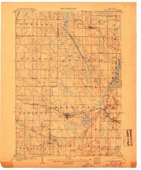 1904 Hartford1904 Print · USGSThe Kettle Moraine region of Washington and Dodge counties comes into focus in this early century survey of Wisconsin’s glacial landscape. Genealogists can trace family roots through small settlements like Schleisingerville, Hochheim, and St. Lawrence, or locate landmarks like Holy Hill and Pike Lake.3 unique versions available
 - 1957 Map of Madison, 1967 Print
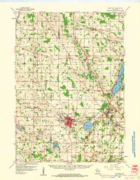
 1957 Madison1967 Print · USGSSouth-central Wisconsin in the mid-fifties reveals a landscape of industrial hubs and glacial lakes linked by a dense rail and highway network. Genealogists and historians can trace the development of lakeside communities and find notable sites like Badger Ordnance Works and the Horicon National Wildlife Refuge.3 unique versions available
 - 1959 Map of Hartford, 1961 Print
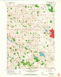
 1959 Hartford1961 Print · USGSSoutheastern Wisconsin's kettle moraine landscape is shown here in the late fifties as rail lines and rural schools defined local life. Trace ancestral roots through sites like Christs Manger Sch Cem, the old Lincoln Sch, and the rail junction at Slinger.2 unique versions available
 - 1959 Map of Nenno, 1964 Print
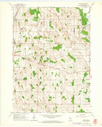 1959 Nenno1964 Print · USGSThe rural borderlands of Dodge and Washington counties are documented here in the late fifties, showcasing a landscape of drumlins and dairy farms. Genealogists can trace family footprints through the many district schools and cemeteries like Reform Cem, Liberty Sch, and Herman Center.3 unique versions available
 - 1959 Map of Allenton, 1964 Print
 1959 Allenton1964 Print · USGSWashington County was a patchwork of family farms and glacial marshes in the late fifties. Genealogists can trace rural communities like Kohlsville and Nabob or locate family plots at Sacred Heart Cem and Kewaskum Union Cem.2 unique versions available
 - 1959 Map of Hartford East, 1964 Print
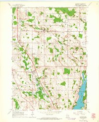
 1959 Hartford East1964 Print · USGSMid-century Washington County is captured here at a time when rail lines and rural schools defined the community. Genealogists can trace family roots through landmarks like Union Cem, St Augustine Sch, and the junction at Slinger.3 unique versions available
 - 1959 Map of Hartford West, 1964 Print
 1959 Hartford West1964 Print · USGSDodge and Washington Counties are shown here in the late fifties as the area balanced industrial growth with its agricultural roots. Genealogists can trace family landmarks through numerous sites like Hallowell Cemetery, Saylesville, and the St Kilian School.3 unique versions available
 - 1960 Map of Madison
 1960 Madison1960 Print · USGSCentral and Southern Wisconsin are captured in the late fifties, showing the region as its rail-and-river network matured. Trace the paths of the Soo Line RR or locate family roots near Lake Mendota and Horicon National Wildlife Refuge.2 unique versions available
 - 1984 Map of Oconomowoc, 1985 Print
 1984 Oconomowoc1985 Print · USGSSoutheast Wisconsin in the mid-eighties shows a landscape defined by its glacial heritage and expanding metropolitan corridors. Genealogists and historians can trace the development of lakeside communities like Oconomowoc and Pewaukee, or find established settlements such as Watertown and Beaver Dam.
 - 1991 Map of Oconomowoc
 1991 Oconomowoc1991 Print · USGSSoutheastern Wisconsin in the early nineties shows a landscape of glacial lakes and growing suburbs. Trace local history through Aztalan State Park, Carroll College, and the sprawling Horicon Marsh State Wildlife Area.
 - 2022 Map of Hartford East, 2022 Print
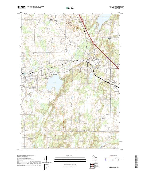 2022 Hartford East2022 Print · USGSThe glacial landscapes of Washington County are captured here in a modern era, showing the transition from lakeside retreats to established towns. Genealogists can locate family sites near Saint Lawrence Cem, Ackerville, and Old Saint Peter Cem.
 - 2022 Map of Allenton, 2022 Print
 2022 Allenton2022 Print · USGSWashington County at the start of the 2020s shows a landscape of enduring rural hamlets and glacial lakes. Local historians can trace family locations near Kohlsville, Allenton, and the Albright United Brethren Cem.
 - 2022 Map of Hartford West, 2022 Print
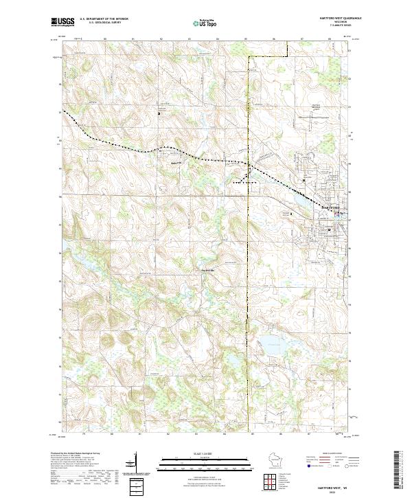 2022 Hartford West2022 Print · USGSEastern Dodge County is captured here in the early twenty-first century as agricultural lands meet the growing town of Hartford. Researchers can trace local lineage through Hallowell Farm Cem or explore the shores of Druid Lake and the Rubicon River.
 - 2022 Map of Nenno, 2022 Print
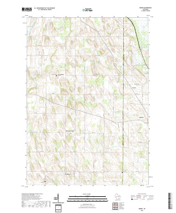 2022 Nenno2022 Print · USGSDodge and Washington counties are shown in this recent survey of Wisconsin’s dairy country. Researchers can trace family roots at Hochheim Cem and Reform Cem or locate old community centers like Nenno and Huilsburg.
End of results
Showing maps 1-14 of 14
Top cities near Addison
- Menomonee Falls historical maps
- West Bend historical maps
- Germantown historical maps
- Hartford historical maps
- Richfield historical maps
- Lisbon historical maps
See more
Top neighborhoods of Addison
- Saint Anthony historical maps
- Saint Lawrence historical maps
- Allenton historical maps
- Aurora historical maps
- Nenno historical maps
Frequently asked questions
- What are the different types of historical maps available for Addison?
- What is the oldest map of Addison?
- Where can I purchase historical maps of Addison for my home or office?
- Where can I download high-res historical maps of Addison?
- Are there historical topographic maps available for Addison?
- Is there historical aerial imagery available for Addison?
- Where are historical maps of Addison sourced from?