2020s Maps of Wautoma, Wisconsin
Explore 4 historic maps of Wautoma from the 2020s. These maps offer a rare glimpse into what life looked like during the 2020s — showing old roads, neighborhoods, homes, and landmarks that have changed or disappeared over time.
Whether you're researching your family's past, planning a metal detecting trip, or studying how Wautoma's landscape evolved across the 2020s, these high-resolution maps are a powerful tool for exploring the history of this region.
- Focus on a specific era: All maps on this page are from the 2020s, giving you a focused view of this time period.
- See what’s changed: Compare century-old streets, trails, and buildings to today's modern landscape using overlays and satellite layers.
- Research with precision: Use these maps for genealogy, historical research, land use analysis, or educational projects.
- View, download, or print: Maps are fully viewable online in high resolution, and can be downloaded or printed for your own records.
Start exploring Wautoma's history through authentic maps from the 2020s. This is your window into the past.
Wautoma, WI maps
(4)- 2022 Map of Wild Rose, 2022 Print
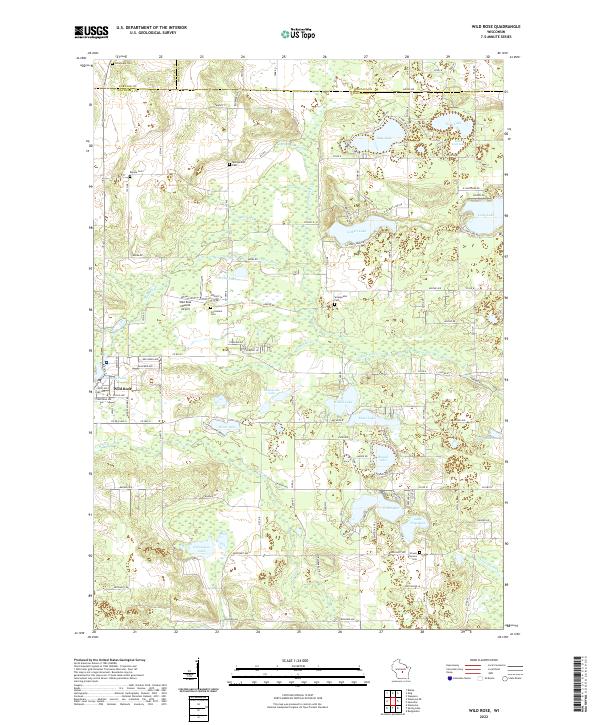 2022 Wild Rose2022 Print · USGSThe lakeside communities of Waushara County are captured here during a period of steady growth and recreational importance. Researchers can trace family sites near Wild Rose, locate the Caersalem Cem, or explore the shores of Gilbert Lake and Silver Lake.
 - 2022 Map of Wautoma, 2022 Print
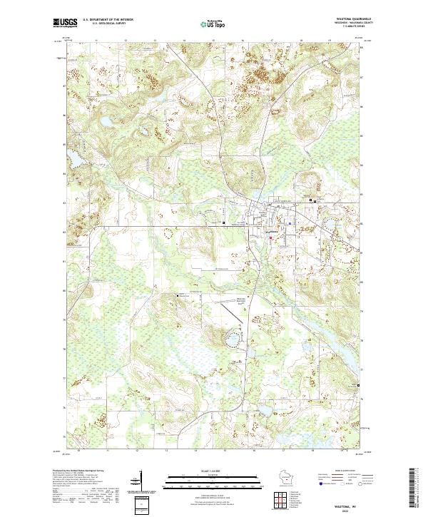 2022 Wautoma2022 Print · USGSThe city of Wautoma and the surrounding lake country are shown here in the early twenty-first century as a well-developed regional hub. Genealogists can trace family names through local burial grounds like Wautoma Union Cem and Maple Grove Cem.
 - 2022 Map of Wautoma NE, 2022 Print
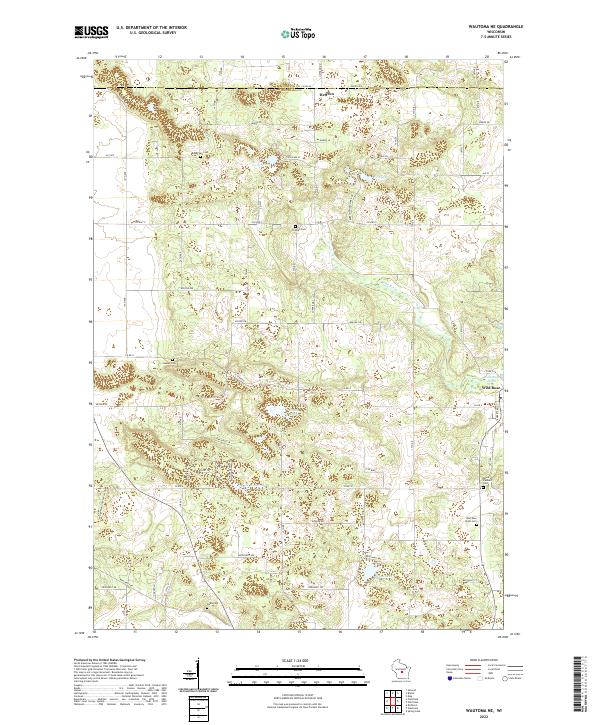 2022 Wautoma NE2022 Print · USGSWaushara County reveals its character through a dense network of glacial lakes and pioneer burial grounds during the early twenty-first century. Researchers can trace the Ice Age National Scenic Trail as it passes Lake Wautoma and locate local family histories at Bohemian Cem or Staples Cem.
 - 2022 Map of Spring Lake, 2022 Print
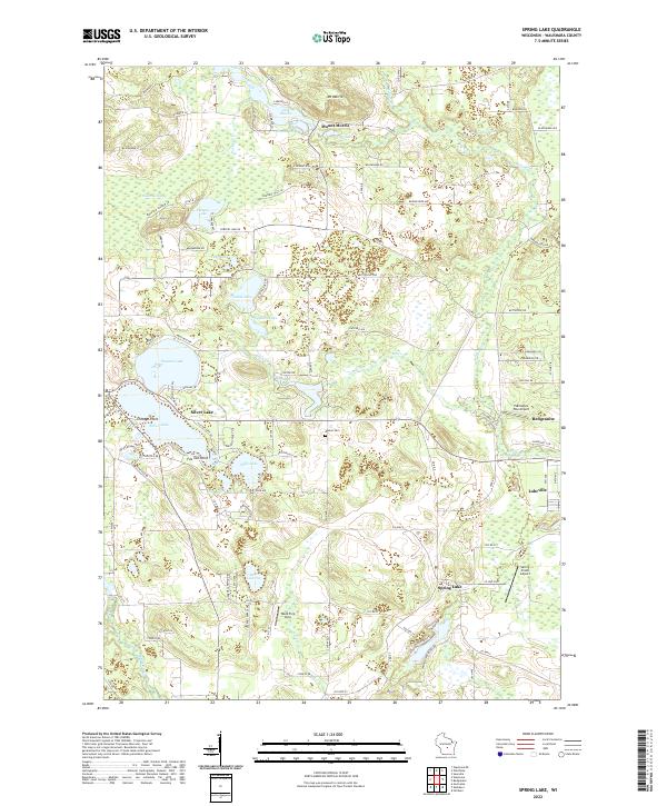 2022 Spring Lake2022 Print · USGSWaushara County’s lake-dotted landscape is captured here in the early twenty-first century, showing the balance between seasonal lakeside life and rural agriculture. Researchers can trace land ownership and property boundaries near Mount Morris, Redgranite, and the historic Marion Cem.
End of results
Showing maps 1-4 of 4
Top cities near Wautoma
- Waupaca historical maps
- Wautoma historical maps
- Redgranite historical maps
- Wild Rose historical maps
- Bancroft historical maps
- Plainfield historical maps
See more
Frequently asked questions
- What are the different types of historical maps available for Wautoma?
- What is the oldest map of Wautoma?
- Where can I purchase historical maps of Wautoma for my home or office?
- Where can I download high-res historical maps of Wautoma?
- Are there historical topographic maps available for Wautoma?
- Is there historical aerial imagery available for Wautoma?
- Where are historical maps of Wautoma sourced from?