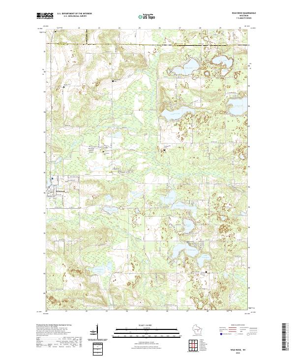
2022 Map of Wild Rose
USGS Topo · Published 2022About this map
Wild Rose sits at the heart of this central Wisconsin landscape, where the Pine River and Willow Cr wind through a dense concentration of glacial kettle lakes. The settlement pattern is defined by these water bodies, with clusters of homes and roads encircling Gilbert Lake, Kusel Lake, and Silver Lake. In the northern reaches, the county lines for Portage Co, Waushara Co, and Waupaca Co converge, marking a quiet agricultural and recreational borderland.
Find a feature on this map
121 named features on this map. Tap any name to fly to it.
Don’t see what you’re looking for? This feature index may not catch every label — zoom into the map to look around manually.
Map Details
Editions of this 2022 Wild Rose Map
This is the sole edition of this map. No revisions or reprints were ever made.
Other maps of this area

1955 · Green Bay
USGS Topo · 1:250,000

1957 · Amherst
USGS Topo · 1:48,000

1957 · Waupaca
USGS Topo · 1:48,000

1959 · Wautoma
USGS Topo · 1:48,000

1961 · Redgranite
USGS Topo · 1:62,500

1961 · Saxeville
USGS Topo · 1:24,000

1961 · Wild Rose
USGS Topo · 1:24,000
1961 · Redgranite
USGS Topo · 1:24,000

1961 · Spring Lake
USGS Topo · 1:24,000
1968 · Wautoma
USGS Topo · 1:24,000