Old Maps of Oberg Ranch, Wyoming for Metal Detecting
Plan your next treasure hunt with 13 historic maps of Oberg Ranch. Find old homesites, ghost towns, trails, and gathering spots that may be lost to time — perfect for identifying promising metal detecting locations.
- Locate forgotten sites: Uncover places like long-lost settlements, abandoned rail lines, or gathering spots.
- Plan better hunts: Use map overlays combined with LiDAR or satellite views to narrow in on historically rich areas.
- Made for detectorists: Thousands of hobbyists use these maps to discover relics, coins, and hidden history.
Use these historic maps to boost your research and find new opportunities beneath the surface of Oberg Ranch.
Oberg Ranch, WY maps
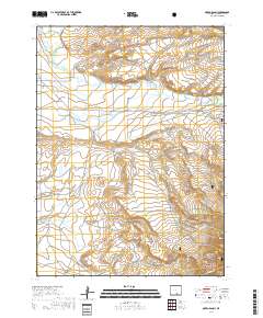
(13)- 1893 Map of Fort Steele
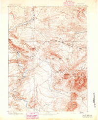 1893 Fort Steele1893 Print · USGSCarbon County in the early 1890s is a rugged landscape dominated by the high-altitude peaks of the Snowy Range and the iron path of the Union Pacific Ry. Genealogists and historians can trace the early rail stops at Hanna, Dana, and Ft Steele alongside the winding course of the North Platte River.4 unique versions available
 - 1954 Map of Rawlins, 1968 Print
 1954 Rawlins1968 Print · USGSThe high plains and mountain ranges of southern Wyoming are shown here in the mid-1950s as the Union Pacific railroad and early highways fueled local industry. Genealogists and historians can trace old homesteads and outposts like the Overland Stage Station, the Utah Oil Refining Station, and the Hadsell Winter Headquarters.2 unique versions available
 - 1955 Map of Oberg Ranch, 1957 Print
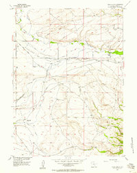 1955 Oberg Ranch1957 Print · USGSCarbon County ranching life is frozen in time during the mid-1950s, showing a landscape defined by cattle operations and vital water rights. Researchers can trace the heritage of family sites like Oberg Ranch or locate the site of the Standard Pass Creek Sch.3 unique versions available
 - 1958 Map of Rawlins
 1958 Rawlins1958 Print · USGSSouthern Wyoming at the mid-century shows a landscape defined by the Union Pacific Railroad and the high basins of the Continental Divide. Researchers can trace old transportation routes near Fort Fred Steele or explore the mining history around Hanna and Medicine Bow.2 unique versions available
 - 1962 Map of Rawlins
 1962 Rawlins1962 Print · USGSSouthern Wyoming at the dawn of the sixties shows a landscape shaped by the Union Pacific and the high peaks of the Medicine Bow Mountains. Researchers can trace the path of the old stage routes through Overland Stage Station and Fort Fred Steele.
 - 1967 Map of Rawlins
 1967 Rawlins1967 Print · USGSCentral Wyoming and northern Colorado in the 1980s are defined here by the Union Pacific corridor and the high peaks of the Sierra Madre. Researchers can trace the legacy of old mining and rail towns like Carbon, Hanna, and Medicine Bow along the Overland Trail.
 - 1980 Map of Medicine Bow
 1980 Medicine Bow1980 Print · USGSCarbon County’s high plains and industrial corridors are captured here in the late twentieth century, centered on the coal-rich territory around Hanna. Genealogists and historians can trace the paths of the historic Overland Trail and the Union Pacific Railroad past settlements like Elmo and Fort Steele.
 - 1988 Map of Rawlins
 1988 Rawlins1988 Print · USGSSouthern Wyoming and the Colorado borderlands are detailed here in the late eighties, featuring the intersection of the historic Overland Trail and the Union Pacific. Researchers can trace old rail towns like Medicine Bow and Wamsutter or landmark peaks like Medicine Bow Peak.
 - 1992 Map of Oberg Ranch, 1996 Print
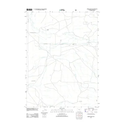
 1992 Oberg Ranch1996 Print · USGSCarbon County ranching and irrigation are captured here in the early nineties, showing a landscape defined by water rights and family holdings. Researchers can trace historic homesteads like Oberg Ranch and the Standard Pass Creek Sch, or locate the site of the Old Pennock Place.
 - 2012 Map of Oberg Ranch, 2012 Print
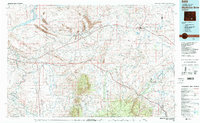
 2012 Oberg Ranch2012 Print · USGSCovers Oberg Ranch, including Carbon County, United States, and other nearby areas
 - 2015 Map of Oberg Ranch, 2015 Print
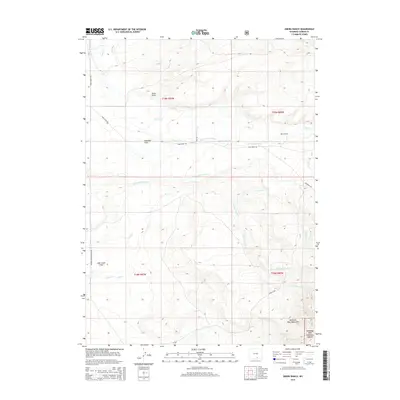 2015 Oberg Ranch2015 Print · USGSCovers Oberg Ranch, including Carbon County, United States, and other nearby areas
 - 2017 Map of Oberg Ranch, 2017 Print
 2017 Oberg Ranch2017 Print · USGSCovers Oberg Ranch, including Carbon County, United States, and other nearby areas
 - 2021 Map of Oberg Ranch, 2021 Print
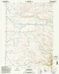
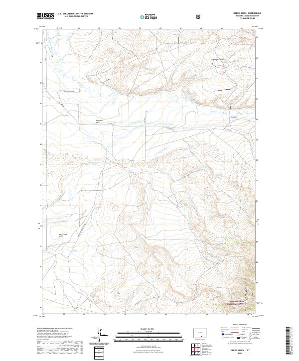 2021 Oberg Ranch2021 Print · USGSCarbon County ranching life is on full display in this modern survey of the high plains and mountain foothills. Trace the complex irrigation history of the region through the Shelton Allen Ditch and the family-named Oberg Ranch or Overland Flats.
End of results
Showing maps 1-13 of 13
Top cities near Oberg Ranch
Frequently asked questions
- What are the different types of historical maps available for Oberg Ranch?
- What is the oldest map of Oberg Ranch?
- Where can I purchase historical maps of Oberg Ranch for my home or office?
- Where can I download high-res historical maps of Oberg Ranch?
- Are there historical topographic maps available for Oberg Ranch?
- Is there historical aerial imagery available for Oberg Ranch?
- Where are historical maps of Oberg Ranch sourced from?