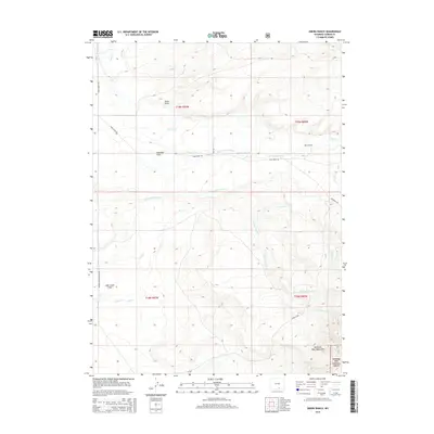
2015 Map of Oberg Ranch
USGS Topo · Published 2015About this map
Oberg Ranch sits at the heart of this high-plains landscape, where the northern reaches of the Medicine Bow Mountains descend into open cattle country. This 2015 USGS survey documents a complex system of water management essential to the high desert, featuring an extensive network of irrigation infrastructure including the Ault Highline Ditch, Kincaid Ditch, and Nickel Scribner Ditch. These man-made watercourses traverse Overland Flats and Lake Creek Flats, illustrating the engineering required to sustain ranching on these arid plateaus. Historical transportation routes are prominent, most notably the Cherokee Trl and a designated Stock Drive Way, which follow natural corridors established by generations of travel. The southeastern portion of the map transitions into the wooded slopes of the Medicine Bow National Forest, defined by drainages like Headquarters Cr and Deer Cr.
Find a feature on this map
34 named features on this map. Tap any name to fly to it.
Don’t see what you’re looking for? This feature index may not catch every label — zoom into the map to look around manually.
Map Details
Editions of this 2015 Oberg Ranch Map
This is the sole edition of this map. No revisions or reprints were ever made.
Other maps of this area

1893 · Fort Steele
USGS Topo · 1:125,000

1939 · Saratoga
USGS Topo · 1:125,000

1954 · Rawlins
USGS Topo · 1:250,000

1955 · Overland
USGS Topo · 1:24,000

1955 · Coal Bank Basin
USGS Topo · 1:24,000

1955 · Oberg Ranch
USGS Topo · 1:24,000

1955 · Meads
USGS Topo · 1:24,000

1955 · Rattlesnake Pass
USGS Topo · 1:24,000

1955 · Coad Mountain
USGS Topo · 1:24,000

1958 · Rawlins
USGS Topo · 1:250,000