
1955 Map of Rattlesnake Pass
USGS Topo · Published 1957About this map
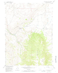
The Overland Trail cuts across the high Wyoming landscape in this mid-century survey, tracing a historic path through Rattlesnake Pass. The area is defined by the massive rise of Elk Mountain and the prominent Halleck Ridge, where high-altitude drainage systems like Rattlesnake Creek and Halleck Creek carve through the terrain. Evidence of the region’s ranching history and early infrastructure is visible at Mullen Ranch and Palm Ranch, while the Fort Halleck Memorial marks a site of military and pioneer significance.
Find a feature on this map
19 named features on this map. Tap any name to fly to it.
Don’t see what you’re looking for? This feature index may not catch every label — zoom into the map to look around manually.
Map Details
Editions of this 1955 Rattlesnake Pass Map
3 editions found
Other maps of this area

1893 · Fort Steele
USGS Topo · 1:125,000

1914 · Hanna
USGS Topo · 1:62,500

1914 · Saddleback Hills
USGS Topo · 1:62,500

1921 · Saddleback Hills
USGS Topo · 1:62,500

1954 · Rawlins
USGS Topo · 1:250,000

1955 · Coal Bank Basin
USGS Topo · 1:24,000

1955 · Elk Mountain
USGS Topo · 1:24,000

1955 · Elk Mountain SW
USGS Topo · 1:24,000

1955 · Oberg Ranch
USGS Topo · 1:24,000

1955 · Coad Mountain
USGS Topo · 1:24,000