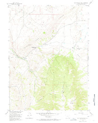
1955 Map of Rattlesnake Pass
USGS Topo · Published 1974About this map
The Overland Trail cuts through this high-altitude landscape, following a corridor between Halleck Ridge and the massive northern slopes of Elk Mountain. By the mid-1950s, the era's infrastructure had begun to overlay the historical pioneer route, visible through a network of a Telephone Line and underground cables that parallel the old road. The Fort Halleck Memorial stands as a quiet marker of the region's military past, located near the Palm Ranch and Halleck Creek.
Find a feature on this map
17 named features on this map. Tap any name to fly to it.
Don’t see what you’re looking for? This feature index may not catch every label — zoom into the map to look around manually.
Map Details
Editions of this 1955 Rattlesnake Pass Map
3 editions found
Other maps of this area

1893 · Fort Steele
USGS Topo · 1:125,000

1914 · Hanna
USGS Topo · 1:62,500

1914 · Saddleback Hills
USGS Topo · 1:62,500

1921 · Saddleback Hills
USGS Topo · 1:62,500

1954 · Rawlins
USGS Topo · 1:250,000

1955 · Coal Bank Basin
USGS Topo · 1:24,000

1955 · Elk Mountain
USGS Topo · 1:24,000

1955 · Elk Mountain SW
USGS Topo · 1:24,000

1955 · Oberg Ranch
USGS Topo · 1:24,000

1955 · Rattlesnake Pass
USGS Topo · 1:24,000