Old Maps of Boxelder, Wyoming
Explore 6 old maps of Boxelder, spanning from 1954 to today. These high-resolution historic maps reveal how streets, neighborhoods, landmarks, and natural features evolved over time — perfect for genealogy, metal detecting, research, and local history exploration.
What you can do with these maps:
- See how Boxelder changed over time: Compare historical maps to modern-day views to trace roads, homesites, rail lines & more.
- View detailed metadata: Each map includes creators, publishers, year, scale, and archive source.
- Overlay maps with satellite & LiDAR: Visualize the past alongside modern tools to explore terrain & human change.
- Trusted historical sources: Maps sourced from the USGS, Library of Congress, and other archives.
- Access maps your way: View online, download high-res files, or order prints for personal or research use.
Start exploring old maps of Boxelder to uncover forgotten places, hidden landmarks, and the deep history beneath your feet.
Boxelder, WY maps
(6)- 1954 Map of Torrington, 1963 Print
 1954 Torrington1963 Print · USGSEastern Wyoming and the Nebraska borderlands are captured here during the mid-fifties, showing a landscape shaped by the Platte River and the Laramie Range. Researchers can trace deep history at the Fort Laramie National Historical Site, the Old Doty Ranch Site, and along the Old Fetterman Road.4 unique versions available
 - 1958 Map of Torrington
 1958 Torrington1958 Print · USGSEastern Wyoming and the Nebraska borderlands are captured in the late fifties, showcasing a landscape of high plains ranching and river-fed industry. Trace the historic paths of the Union Pacific railroad and find legacy sites like Fort Laramie and Sunrise.
 - 1964 Map of Buffalo Peak, 1968 Print
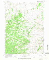 1964 Buffalo Peak1968 Print · USGSConverse County high country in the 1960s was a landscape of remote mountain outposts and seasonal ranching infrastructure. Genealogists and local historians can trace the paths of old Jeep Trails connecting Silver Spruce Lodge, Ollins Lode, and the landmark Standing Rock.2 unique versions available
 - 1981 Map of Douglas
 1981 Douglas1981 Print · USGSThe North Platte River corridor in the early eighties shows a landscape shaped by energy and iron. Genealogists and industrial historians can trace rail-side settlements like Glenrock, explore the Big Muddy Oil Field, and locate the old siding at Fetterman.
 - 1992 Map of Buffalo Peak, 1996 Print
 1992 Buffalo Peak1996 Print · USGSThe high country of Converse County is captured here in the early nineties, showing a landscape defined by the Medicine Bow National Forest. Researchers can trace remote sites like Silver Spruce Lodge, geologic landmarks like Bear Rock, and the deep cut of the La Prele Gorge.
 - 2021 Map of Buffalo Peak, 2021 Print
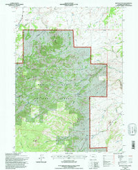
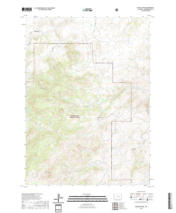 2021 Buffalo Peak2021 Print · USGSConverse County's high-country terrain is captured here in the early 2020s within the Medicine Bow National Forest. Researchers can trace the remote settlement of Boxelder and navigate landmarks like Buffalo Peak, Standing Rock, and Peterson Mtn.
End of results
Showing maps 1-6 of 6
Top cities near Boxelder
Frequently asked questions
- What are the different types of historical maps available for Boxelder?
- What is the oldest map of Boxelder?
- Where can I purchase historical maps of Boxelder for my home or office?
- Where can I download high-res historical maps of Boxelder?
- Are there historical topographic maps available for Boxelder?
- Is there historical aerial imagery available for Boxelder?
- Where are historical maps of Boxelder sourced from?