1960s Maps of Kirwin, Wyoming
Explore 2 historic maps of Kirwin from the 1960s. These maps offer a rare glimpse into what life looked like during the 1960s — showing old roads, neighborhoods, homes, and landmarks that have changed or disappeared over time.
Whether you're researching your family's past, planning a metal detecting trip, or studying how Kirwin's landscape evolved across the 1960s, these high-resolution maps are a powerful tool for exploring the history of this region.
- Focus on a specific era: All maps on this page are from the 1960s, giving you a focused view of this time period.
- See what’s changed: Compare century-old streets, trails, and buildings to today's modern landscape using overlays and satellite layers.
- Research with precision: Use these maps for genealogy, historical research, land use analysis, or educational projects.
- View, download, or print: Maps are fully viewable online in high resolution, and can be downloaded or printed for your own records.
Start exploring Kirwin's history through authentic maps from the 1960s. This is your window into the past.
Kirwin, WY maps
(2)- 1962 Map of Thermopolis
 1962 Thermopolis1962 Print · USGSThe Wind River and Bighorn basins are meticulously mapped in the early sixties, showing the vital irrigation and rail networks of the era. Genealogists and historians can locate specific landmarks like the Duncan Ranch School, the Wyoming Industrial Institute, and the Hamilton Dome oil field.
 - 1969 Map of Francs Peak, 1971 Print
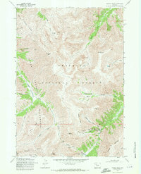 1969 Francs Peak1971 Print · USGSThe high Absaroka Range is captured here during the late sixties, centered on the remote mining outpost of Kirwin. Researchers can trace early industrial footprints through features like the Gold Reef Tunnel, Anaconda Mine, and Wolf Shaft.2 unique versions available
End of results
Showing maps 1-2 of 2
Frequently asked questions
- What are the different types of historical maps available for Kirwin?
- What is the oldest map of Kirwin?
- Where can I purchase historical maps of Kirwin for my home or office?
- Where can I download high-res historical maps of Kirwin?
- Are there historical topographic maps available for Kirwin?
- Is there historical aerial imagery available for Kirwin?
- Where are historical maps of Kirwin sourced from?