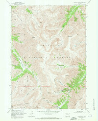
1969 Map of Francs Peak
USGS Topo · Published 1971About this map
The high-altitude mining district of Kirwin serves as a focal point for this late 1960s survey of the Absaroka Range. Located within the Shoshone National Forest, this region is defined by its deep alpine basins and the extractive industry that once drove its remote economy. The map meticulously documents a high concentration of mining claims and infrastructure along the headwaters of the Wood Creek and the Greybull River. Notable operations such as the Anaconda Mine, Gold Reef Tunnel, and Mendota Mine are situated under the shadows of Francs Peak and Chief Mountain. The landscape is a network of steep ridges like Galena Ridge and high-altitude passes including Greybull Pass, illustrating the logistical challenges faced by prospectors in the Brown Basin and Meadow Creek Basin.
Find a feature on this map
47 named features on this map. Tap any name to fly to it.
Don’t see what you’re looking for? This feature index may not catch every label — zoom into the map to look around manually.
Map Details
Editions of this 1969 Francs Peak Map
2 editions found
Other maps of this area

1904 · Kirwin
USGS Topo · 1:125,000

1906 · Kirwin
USGS Topo · 1:125,000

1955 · Cody
USGS Topo · 1:250,000

1955 · Thermopolis
USGS Topo · 1:250,000

1957 · Irish Rock
USGS Topo · 1:62,500

1957 · Sunshine Reservoir
USGS Topo · 1:62,500

1958 · Cody
USGS Topo · 1:250,000

1958 · Thermopolis
USGS Topo · 1:250,000

1962 · Thermopolis
USGS Topo · 1:250,000

1962 · Cody
USGS Topo · 1:250,000