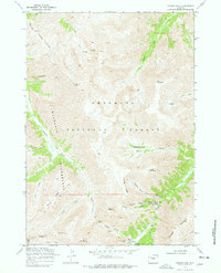
1969 Map of Francs Peak
USGS Topo · Published 1978About this map
The mining settlement of Kirwin sits deep in the high country of the Shoshone National Forest, surrounded by a dense concentration of early extraction sites. This 1969 field-checked survey reveals the complex subterranean network of the era, from the Gold Reef Tunnel to the Wolf Shaft. The geography is defined by the Greybull River and its numerous tributaries like Wood Creek and Meadow Creek, which carved out the basins that miners used to access rich mineral veins.
Find a feature on this map
56 named features on this map. Tap any name to fly to it.
Don’t see what you’re looking for? This feature index may not catch every label — zoom into the map to look around manually.
Map Details
Editions of this 1969 Francs Peak Map
2 editions found
Other maps of this area

1904 · Kirwin
USGS Topo · 1:125,000

1906 · Kirwin
USGS Topo · 1:125,000

1955 · Cody
USGS Topo · 1:250,000

1955 · Thermopolis
USGS Topo · 1:250,000

1957 · Irish Rock
USGS Topo · 1:62,500

1957 · Sunshine Reservoir
USGS Topo · 1:62,500

1958 · Cody
USGS Topo · 1:250,000

1958 · Thermopolis
USGS Topo · 1:250,000

1962 · Thermopolis
USGS Topo · 1:250,000

1962 · Cody
USGS Topo · 1:250,000