1970s Maps of Sublette County, Wyoming
Explore 9 historic maps of Sublette County from the 1970s. These maps offer a rare glimpse into what life looked like during the 1970s — showing old roads, neighborhoods, homes, and landmarks that have changed or disappeared over time.
Whether you're researching your family's past, planning a metal detecting trip, or studying how Sublette County's landscape evolved across the 1970s, these high-resolution maps are a powerful tool for exploring the history of this region.
- Focus on a specific era: All maps on this page are from the 1970s, giving you a focused view of this time period.
- See what’s changed: Compare century-old streets, trails, and buildings to today's modern landscape using overlays and satellite layers.
- Research with precision: Use these maps for genealogy, historical research, land use analysis, or educational projects.
- View, download, or print: Maps are fully viewable online in high resolution, and can be downloaded or printed for your own records.
Start exploring Sublette County's history through authentic maps from the 1970s. This is your window into the past.
Sublette County, WY maps
(9)- 1970 Map of Daniel Junction, 1973 Print
 1970 Daniel Junction1973 Print · USGSUpper Green River ranching country in the early seventies is defined here by a sophisticated network of canals and reservoirs. Genealogists and local historians can trace family-named landmarks and water rights via Ashley Ditch, Jenkins Ditch, and the settlement of Bronx.
 - 1970 Map of Budd Reservoir, 1973 Print
 1970 Budd Reservoir1973 Print · USGSIn the early seventies, this part of Wyoming was characterized by its essential water infrastructure and high-plains terrain. You can trace the path of the Joe Budd Supply Ditch to Budd Reservoir or locate Dead Indian Dome.
 - 1970 Map of Big Piney West, 1973 Print
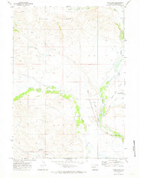
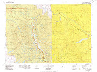
 1970 Big Piney West1973 Print · USGSSublette County ranching and oil development are captured here in the early seventies as irrigation ditches spread across the Green River Basin. Trace pioneer history along the Emigrant Trail or locate family landmarks like Plainview Cem and the Ruben Oil Field.2 unique versions available
 - 1970 Map of Daniel, 1973 Print
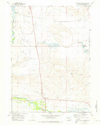
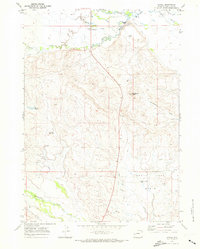 1970 Daniel1973 Print · USGSThe high-country ranching landscape of Sublette County is captured here in the early seventies, centered on the settlement of Daniel. Genealogists and researchers can trace the intricate irrigation network of the Green River, including Mt Olivet Cem, Soaphole Bridge, and Grindstone Butte.
 - 1970 Map of Webb Draw, 1973 Print
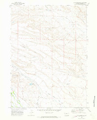
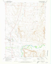
 1970 Webb Draw1973 Print · USGSSublette County ranch lands and river bottoms are captured here in the early seventies as the Green River winds past historic sites. Researchers can locate the Old Fort Bonneville Site, the Wilhelm Cem, and trace the path of Forty Rod Road across the flats.
 - 1970 Map of Ball Island, 1973 Print
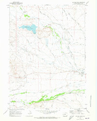
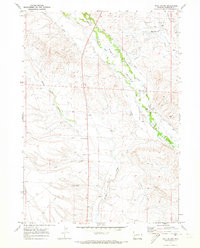 1970 Ball Island1973 Print · USGSSublette County ranching country comes into focus in the 1970s, showing a high-plains landscape shaped by an extensive network of irrigation canals. Genealogists and historians can trace family land via Luman Road, Ball Cem, and named waterways like Essex Ditch.
 - 1970 Map of Onion Springs, 1973 Print
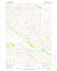 1970 Onion Springs1973 Print · USGSHigh-desert ranching and water management in Sublette County come into focus during the early seventies. Genealogists and researchers can trace local land use through features like Onion Springs, Lindback Ditch, and the Jewett Red Flat Reservoir.
 - 1970 Map of Big Piney East, 1973 Print
 1970 Big Piney East1973 Print · USGSSublette County settlement and irrigation are well-established by the early seventies in this high-basin study. Genealogists and historians can trace the Emigrant Trail (Lander Cutoff) and local landmarks like the Ferry and Big Piney.2 unique versions available
 - 1978 Map of Gannett Peak, 1979 Print
 1978 Gannett Peak1979 Print · USGSThe high peaks of the Wind River Range meet the plains in the late seventies. Researchers can trace the Continental Divide past Gannett Peak or locate riverfront settlements like Crowheart and Burris.2 unique versions available
End of results
Showing maps 1-9 of 9
Top cities of Sublette County
Frequently asked questions
- What are the different types of historical maps available for Sublette County?
- What is the oldest map of Sublette County?
- Where can I purchase historical maps of Sublette County for my home or office?
- Where can I download high-res historical maps of Sublette County?
- Are there historical topographic maps available for Sublette County?
- Is there historical aerial imagery available for Sublette County?
- Where are historical maps of Sublette County sourced from?