1960s Maps of Sublette County, Wyoming
Explore 79 historic maps of Sublette County from the 1960s. These maps offer a rare glimpse into what life looked like during the 1960s — showing old roads, neighborhoods, homes, and landmarks that have changed or disappeared over time.
Whether you're researching your family's past, planning a metal detecting trip, or studying how Sublette County's landscape evolved across the 1960s, these high-resolution maps are a powerful tool for exploring the history of this region.
- Focus on a specific era: All maps on this page are from the 1960s, giving you a focused view of this time period.
- See what’s changed: Compare century-old streets, trails, and buildings to today's modern landscape using overlays and satellite layers.
- Research with precision: Use these maps for genealogy, historical research, land use analysis, or educational projects.
- View, download, or print: Maps are fully viewable online in high resolution, and can be downloaded or printed for your own records.
Start exploring Sublette County's history through authentic maps from the 1960s. This is your window into the past.
Sublette County, WY maps
(79)- 1961 Map of Lander
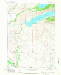
 1961 Lander1961 Print · USGSThe high peaks and desert basins of central Wyoming appear here in the early sixties, showing the landscape of the Shoshone Indian Reservation and the Wind River Range. Researchers can trace the path of the Oregon Trail and locate early settlements like Lander and the mining remains at South Pass City.2 unique versions available
 - 1962 Map of Thermopolis
 1962 Thermopolis1962 Print · USGSThe Wind River and Bighorn basins are meticulously mapped in the early sixties, showing the vital irrigation and rail networks of the era. Genealogists and historians can locate specific landmarks like the Duncan Ranch School, the Wyoming Industrial Institute, and the Hamilton Dome oil field.
 - 1962 Map of Driggs
 1962 Driggs1962 Print · USGSThe Idaho-Wyoming borderlands are captured here in the early sixties, showing the peaks and valleys of the northern Rockies. Genealogists and historians can trace rail lines like the Union Pacific RR and isolated outposts like the National Elk Refuge or the Fort Hall Indian Reservation.
 - 1962 Map of Preston
 1962 Preston1962 Print · USGSSoutheast Idaho and the Wyoming borderlands are captured here in the early sixties, a time of thriving agricultural valleys and mountain ranching. Researchers can trace the Union Pacific rail lines and find legacy settlements like Montpelier, Afton, and Preston.
 - 1964 Map of Fremont Butte, 1966 Print
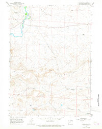
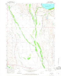
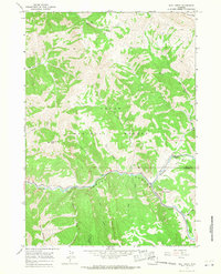
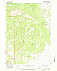
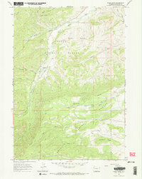
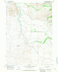 1964 Fremont Butte1966 Print · USGSThe high desert of Sublette County is documented here in the mid-1960s, where historical trails meet modern ranching and energy needs. Genealogists and historians can trace the path of the Lander Cut-off and locate landmarks like Fremont Butte and the Fremont Butte Well.
 - 1964 Map of Two Buttes Reservoir, 1968 Print
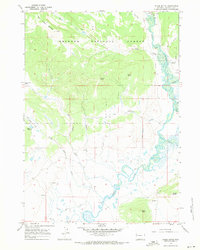
 1964 Two Buttes Reservoir1968 Print · USGSSublette County ranching and water management are front and center in the mid-1960s as irrigation networks trace the high plains. Researchers can locate specific water rights and ranch boundaries along the New Fork River, Paradise Ditch, and the Blue Rim Drift Fence.2 unique versions available
 - 1964 Map of Square Top, 1968 Print
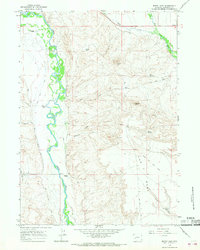
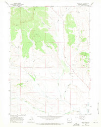
 1964 Square Top1968 Print · USGSSublette County ranch lands and historic transit corridors are preserved here as they appeared in the early sixties. History buffs and researchers can trace the historic Emigrant Trail past remote livestock waterings like Lost Reservoir and Antelope Spring.2 unique versions available
 - 1964 Map of Ross Butte, 1968 Print
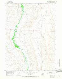
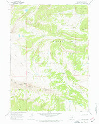
 1964 Ross Butte1968 Print · USGSThe confluence of the Green and New Fork rivers defines this mid-century Wyoming landscape where desert ranching and pioneer history intersect. You can trace the path of the Emigrant Trail and locate specialized irrigation works like Hanna Ditch and Bertram Ditch.2 unique versions available
 - 1964 Map of Boulder Lake, 1968 Print
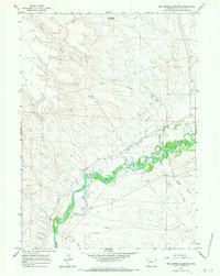
 1964 Boulder Lake1968 Print · USGSThe high plains of Sublette County meet the forest edge in the mid-1960s, defined by a complex network of irrigation ditches and mountain rivers. Genealogists and historians can trace family-named landmarks like the Boulder Cemetery or the Howard Routh Ditch near Boulder.3 unique versions available
 - 1964 Map of Olsen Ranch, 1968 Print
 1964 Olsen Ranch1968 Print · USGSSublette County ranching and historic migration routes are preserved in this mid-sixties survey of the Wyoming high desert. Researchers can trace the original Emigrant Trail and the remote Olsen Ranch alongside the Blue Rim Drift Fence.2 unique versions available
 - 1964 Map of Mount Airy, 1968 Print
 1964 Mount Airy1968 Print · USGSSublette County ranching and water management are frozen in time during the mid-sixties, where the braided Green River meets the high plateau. Researchers can trace the heritage of established operations like Sommers Ranch and Grubbing Hoe Ranch alongside early energy markers like Gas Wells.2 unique versions available
 - 1964 Map of Mesa Spring, 1968 Print
 1964 Mesa Spring1968 Print · USGSThe Upper Green River Valley in the 1960s is defined here by its ranching heritage and the historic Emigrant Trail. Genealogists and historians can trace family-named irrigation systems like Luman Ditch and remote landmarks such as Luman Well.2 unique versions available
 - 1964 Map of Cora, 1968 Print
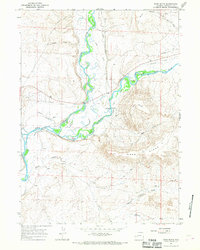
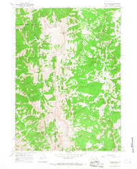
 1964 Cora1968 Print · USGSUpper Green River Valley ranching and early frontier history are preserved here in the mid-1960s. Genealogists and historians can locate legacy holdings like Bar Cross Ranch, the Indian Graves, and the Trappers Point Historical Monument.2 unique versions available
 - 1964 Map of Boulder, 1968 Print
 1964 Boulder1968 Print · USGSThe river bottomlands of Sublette County come alive in the 1960s as a complex network of ranching ditches and reservoirs. Trace family-named landmarks like Vible Cem and Bailey Res No 2, or follow the historic path of the Emigrant Trail.2 unique versions available
 - 1964 Map of Pinedale, 1968 Print
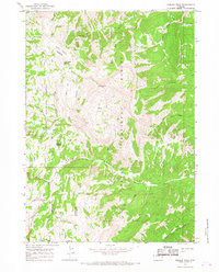
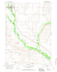 1964 Pinedale1968 Print · USGSPinedale and the surrounding Sublette County cattle country appear in the mid-1960s as a landscape defined by irrigation and high-altitude ranching. Genealogists and historians can locate the Plainview Cem, High Sch, and the winding paths of the New Fork River and Pole Creek.3 unique versions available
 - 1964 Map of Fremont Lake South, 1978 Print
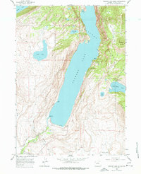 1964 Fremont Lake South1978 Print · USGSNear the town of Pinedale in the 1960s, this area shows the early development of mountain recreation and irrigation. You can trace the historic Skyline Drive and locate mid-century sites like the Winter Sports Area, Ski Lift, and the Sandy Beach Picnic Area.3 unique versions available
 - 1965 Map of Bull Creek, 1968 Print
 1965 Bull Creek1968 Print · USGSTeton and Sublette counties are captured here in the mid-1960s, showing a rugged wilderness defined by the river corridor and high peaks. Researchers can trace early recreational sites like Hoback Campground or locate the remote Mine near Granite Creek.
 - 1965 Map of Hoback Peak, 1968 Print
 1965 Hoback Peak1968 Print · USGSThe high divide between Lincoln and Sublette counties is captured here in the mid-1960s, showing a landscape defined by traditional range use and forest management. Researchers can trace the historic Stock Driveway and Pack Trails used to reach Horse Heaven Meadows and Cliff Creek Falls.
 - 1965 Map of Clause Peak, 1968 Print
 1965 Clause Peak1968 Print · USGSThe high Wyoming backcountry of the mid-sixties is captured here as a remote wilderness where three counties meet. Trail-bound explorers and historians can trace the paths between Clause Peak, Ramshorn Peak, and the namesake Sandy Marshall Creek.
 - 1966 Map of Warren Bridge, 1971 Print
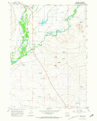
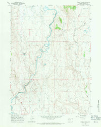 1966 Warren Bridge1971 Print · USGSThe upper Green River basin in the mid-1960s shows a landscape of high-altitude ranching and essential water management. Researchers can trace the complex network of irrigation canals including Canyon Ditch and Horsefly Ditch near Forty Rod Flat.3 unique versions available
 - 1966 Map of Pass Peak, 1971 Print
 1966 Pass Peak1971 Print · USGSThe high divides of Sublette County come into focus during the mid-1960s, documenting the boundary between two national forests. Researchers can trace remote alpine routes including a Pack Trail near Pass Peak and the high waters of Fisherman Creek Lake.2 unique versions available
 - 1966 Map of Dodge Butte, 1971 Print
 1966 Dodge Butte1971 Print · USGSUpper Green River ranching and forestry come into focus in the mid-1960s as this survey traces the valley floor and foothills. Researchers can locate isolated landmarks like the Flying A Ranch, a quiet Cem, and the historical Tie Camp.3 unique versions available
 - 1966 Map of Signal Hill, 1971 Print
 1966 Signal Hill1971 Print · USGSSublette County land was largely shaped by its water rights and high-elevation terrain during the mid-1960s. Researchers can trace early irrigation systems like Lena Ditch and family-named landmarks such as Watson Draw or Signal Hill.2 unique versions available
 - 1967 Map of Tosi Peak, 1970 Print
 1967 Tosi Peak1970 Print · USGSThe high wilderness of Sublette County during the late sixties is revealed through its intricate network of backcountry paths. Trace the old pack trails and jeep trails through the Gros Ventre Range toward Tosi Peak and the Water Dog Lakes.2 unique versions available
 - 1967 Map of Noble Basin, 1970 Print
 1967 Noble Basin1970 Print · USGSSublette County ranching and forest lands are captured here during the late sixties, where the Hoback River cuts through the high country. Researchers can find remote landmarks like the Dead Shot Ranch, its Landing Strip, and the South Fork Pack Trail.3 unique versions available
Showing maps 1-25 of 79
Top cities of Sublette County
Frequently asked questions
- What are the different types of historical maps available for Sublette County?
- What is the oldest map of Sublette County?
- Where can I purchase historical maps of Sublette County for my home or office?
- Where can I download high-res historical maps of Sublette County?
- Are there historical topographic maps available for Sublette County?
- Is there historical aerial imagery available for Sublette County?
- Where are historical maps of Sublette County sourced from?