1940s Maps of Sublette County, Wyoming
Explore 5 historic maps of Sublette County from the 1940s. These maps offer a rare glimpse into what life looked like during the 1940s — showing old roads, neighborhoods, homes, and landmarks that have changed or disappeared over time.
Whether you're researching your family's past, planning a metal detecting trip, or studying how Sublette County's landscape evolved across the 1940s, these high-resolution maps are a powerful tool for exploring the history of this region.
- Focus on a specific era: All maps on this page are from the 1940s, giving you a focused view of this time period.
- See what’s changed: Compare century-old streets, trails, and buildings to today's modern landscape using overlays and satellite layers.
- Research with precision: Use these maps for genealogy, historical research, land use analysis, or educational projects.
- View, download, or print: Maps are fully viewable online in high resolution, and can be downloaded or printed for your own records.
Start exploring Sublette County's history through authentic maps from the 1940s. This is your window into the past.
Sublette County, WY maps
(5)- 1941 Map of Mt Bonneville
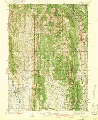
 1941 Mt Bonneville1941 Print · USGSThe high country of the Wind River Range is captured here in the late thirties, documenting the remote alpine terrain of the Washakie National Forest. Researchers can trace historic backcountry routes like the High Line Trail and find isolated landmarks such as the John Day Cabin or Cow Camp.
 - 1942 Map of Cokeville
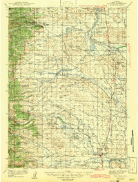
 1942 Cokeville1942 Print · USGSWestern Wyoming migration routes are frozen in time on this survey of Lincoln County in the late thirties. Genealogists and historians can trace the physical paths of the Oregon Trail, find the Upper Hams Fork Sch, and locate remote outposts like Smiths Fork Guard Station.3 unique versions available
 - 1942 Map of Big Piney
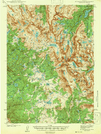
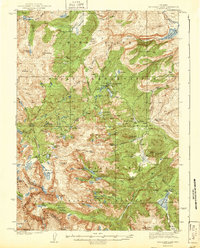
 1942 Big Piney1942 Print · USGSSublette County ranching and frontier history are captured here in the early 1940s, just as the region's irrigation and land management systems were maturing. Genealogists can locate family names and remote landmarks like the Bronx Sch, the Site of Old Ft Bonneville, and the State Fish Hatchery.
 - 1942 Map of Mt Bonneville
 1942 Mt Bonneville1942 Print · USGSHigh mountain wilderness near the Fremont and Sublette County line is documented here in the late thirties. Researchers can locate remote outposts like the South Fork Guard Sta and John Day Cabin along the Continental Divide Trail.2 unique versions available
 - 1943 Map of Moccasin Lake
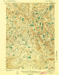
 1943 Moccasin Lake1943 Print · USGSThe Wind River high country is captured here just before the mid-century, spanning the Continental Divide and tribal lands. Researchers can trace the original Washakie Trail and locate remote outposts like the North Fork Guard Sta and Mosquito Park.2 unique versions available
End of results
Showing maps 1-5 of 5
Top cities of Sublette County
Frequently asked questions
- What are the different types of historical maps available for Sublette County?
- What is the oldest map of Sublette County?
- Where can I purchase historical maps of Sublette County for my home or office?
- Where can I download high-res historical maps of Sublette County?
- Are there historical topographic maps available for Sublette County?
- Is there historical aerial imagery available for Sublette County?
- Where are historical maps of Sublette County sourced from?