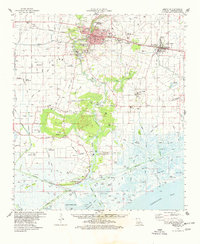
1975 Map of Abbeville
USGS Topo · Published 1978About this map
The Vermilion River serves as the central artery for this south Louisiana landscape, flowing past the hub of Abbeville toward the marshes of Vermilion Bay. During the mid-1970s, the region was defined by a complex network of agriculture and industry, with numerous gas fields and crawfish farms dotting the lowlands. The industrial activity is particularly concentrated at Intracoastal City, where the river meets the Intracoastal Waterway, marking a critical juncture for regional transit and maritime commerce.
Find a feature on this map
75 named features on this map. Tap any name to fly to it.
Don’t see what you’re looking for? This feature index may not catch every label — zoom into the map to look around manually.
Map Details
Editions of this 1975 Abbeville Map
This is the sole edition of this map. No revisions or reprints were ever made.
Other maps of this area

1932 · Abbeville SW
USGS Topo · 1:31,680

1932 · Abbeville SE
USGS Topo · 1:31,680

1932 · Abbeville NE
USGS Topo · 1:31,680

1932 · Abbeville NW
USGS Topo · 1:31,680

1937 · Derouen
USGS Topo · 1:62,500

1939 · St. Martinsville
USGS Topo · 1:62,500

1945 · New Orleans
USGS Topo · 1:250,000

1945 · Pecan Island NE
USGS Topo · 1:31,680

1946 · Milton
USGS Topo · 1:31,680

1946 · Schooner Bayou SE
USGS Topo · 1:31,680