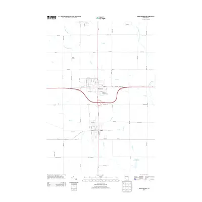
2013 Map of Abbotsford
USGS Topo · Published 2013About this map
Abbotsford and the northern edge of Colby serve as the primary hubs of this Wisconsin landscape, where the intersection of Wi-13 and the Wi-29 expressway dictates the local movement of goods and people. The map illustrates a transition between urban infrastructure, such as the Abbotsford Wastewater Treatment Facility, and the rural agricultural tracts that dominate the surrounding terrain. Small private aviation interests are represented by Jones Airport, located just northwest of the main settlement. The geography is defined by a network of drainage systems, including the Big Eau Pleine River and Porky Cr, which wind through the agricultural sections. In the southeast, the Winding Cr Rearing Pond 1 indicates specialized land use near the banks of Winding Cr. This 2013 survey provides a clear look at the modern road grid, including family-named routes like Broek Rd and Hoeft Rd, which connect the outlying farmsteads to the central townships.
Find a feature on this map
73 named features on this map. Tap any name to fly to it.
Don’t see what you’re looking for? This feature index may not catch every label — zoom into the map to look around manually.
Map Details
Editions of this 2013 Abbotsford Map
This is the sole edition of this map. No revisions or reprints were ever made.
Other maps of this area

1902 · Marathon
USGS Topo · 1:125,000

1951 · Athens
USGS Topo · 1:48,000

1951 · Medford
USGS Topo · 1:48,000

1953 · Abbotsford
USGS Topo · 1:48,000

1953 · Stratford
USGS Topo · 1:48,000

1953 · Eau Claire
USGS Topo · 1:250,000

1953 · Rice Lake
USGS Topo · 1:250,000

1958 · Eau Claire
USGS Topo · 1:250,000

1959 · Rice Lake
USGS Topo · 1:250,000

1963 · Stratford
USGS Topo · 1:62,500