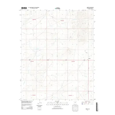
2013 Map of Abbott
USGS Topo · Published 2013About this map
Abbott serves as the primary junction on this high plains landscape, situated where NM-39 intersects with Abbott Rd. The area is characterized by a network of drainage features and depressions, most notably the seasonal waters of Big Lake and East Lake, which stand out against the surrounding terrain. Scattered small settlements and family-named locales such as Gillespie, Messick, Montoya, and Jones suggest a history of ranching and early 20th-century homesteading. The landscape is deeply etched by the winding course of Jaritas Arroyo, which meanders across several townships including t24n r24e and t25n r25e. This topographic record provides a clear view of the rural infrastructure of Colfax County, showing how local transport like Co Road C-46 and Co Road C-67 connects these isolated points across the Northeastern New Mexico plateau.
Find a feature on this map
21 named features on this map. Tap any name to fly to it.
Don’t see what you’re looking for? This feature index may not catch every label — zoom into the map to look around manually.
Map Details
Editions of this 2013 Abbott Map
This is the sole edition of this map. No revisions or reprints were ever made.
Other maps of this area

1954 · Raton
USGS Topo · 1:250,000

1958 · Raton
USGS Topo · 1:250,000

1965 · Sauble Circle Dot Ranch
USGS Topo · 1:24,000

1965 · Abbott NW
USGS Topo · 1:24,000

1965 · Taylor Springs
USGS Topo · 1:24,000

1965 · Abbott
USGS Topo · 1:24,000

1971 · Abbott Lake
USGS Topo · 1:24,000
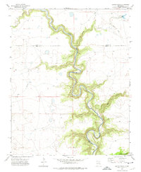
1972 · Jaritas Ranch
USGS Topo · 1:24,000

1974 · Point Of Rocks Mesa
USGS Topo · 1:24,000

1974 · Spear Hills
USGS Topo · 1:24,000