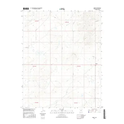
2017 Map of Abbott
USGS Topo · Published 2017About this map
Abbott occupies the eastern edge of this Colfax County landscape, serving as a primary point of reference in an area defined by wide-reaching drainage networks and seasonal water bodies. The terrain is etched by the complex paths of Jaritas Arroyo and the headwaters of Chico Cr and Sauz Cr, reflecting the hydrology of the high plains. Named roads such as Feed Rd and Flying H Rd navigate the grid, indicating the importance of ranching and rural transit in this portion of New Mexico. Distinct features like Big Lake and E Lake appear as localized catchments in a region where water management is central to the land's utility. The map details the Public Land Survey System divisions, including t24n r24e and t24n r25e, which organize the vast open tracts surrounding the small settlement.
Find a feature on this map
23 named features on this map. Tap any name to fly to it.
Don’t see what you’re looking for? This feature index may not catch every label — zoom into the map to look around manually.
Map Details
Editions of this 2017 Abbott Map
This is the sole edition of this map. No revisions or reprints were ever made.
Other maps of this area

1954 · Raton
USGS Topo · 1:250,000

1958 · Raton
USGS Topo · 1:250,000

1965 · Sauble Circle Dot Ranch
USGS Topo · 1:24,000

1965 · Abbott NW
USGS Topo · 1:24,000

1965 · Taylor Springs
USGS Topo · 1:24,000

1965 · Abbott
USGS Topo · 1:24,000

1971 · Abbott Lake
USGS Topo · 1:24,000
1972 · Jaritas Ranch
USGS Topo · 1:24,000

1974 · Point Of Rocks Mesa
USGS Topo · 1:24,000

1974 · Spear Hills
USGS Topo · 1:24,000