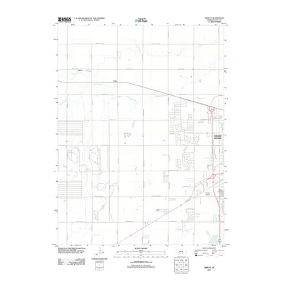
2011 Map of Abbott
USGS Topo · Published 2011About this map
Grand Island expands westward in this 2011 survey, showing a landscape defined by traditional agrarian sections and growing residential street grids. Along the eastern edge, the urban fringe meets several significant memorial sites, including the Westlawn Memorial Cemetery, Soldiers and Sailors Cemetery, and Grand Island Cemetery. These sites provide vital touchpoints for local genealogists and historians tracking the region's heritage. To the northwest, the small settlements of Abbott and Ovina remain distinct, set against a hydrology system of prairie drainage. The winding course of Prairie Creek and the managed waters of Moores Creek and the Hickey Lake Dam illustrate how the Hall County landscape is shaped for both agriculture and development, while the transition from paved city streets like W Old Potash Hwy to rural section roads marks the contemporary boundary of the city's growth.
Find a feature on this map
55 named features on this map. Tap any name to fly to it.
Don’t see what you’re looking for? This feature index may not catch every label — zoom into the map to look around manually.
Map Details
Editions of this 2011 Abbott Map
This is the sole edition of this map. No revisions or reprints were ever made.
Other maps of this area

1892 · Grand Island
USGS Topo · 1:62,500

1895 · Grand Island
USGS Topo · 1:62,500

1895 · Wood River
USGS Topo · 1:62,500

1896 · Wood River
USGS Topo · 1:125,000

1898 · Grand Island
USGS Topo · 1:125,000

1899 · Loup
USGS Topo · 1:125,000

1899 · St. Paul
USGS Topo · 1:125,000

1953 · Dannebrog
USGS Topo · 1:24,000

1955 · Broken Bow
USGS Topo · 1:250,000

1955 · Grand Island
USGS Topo · 1:250,000