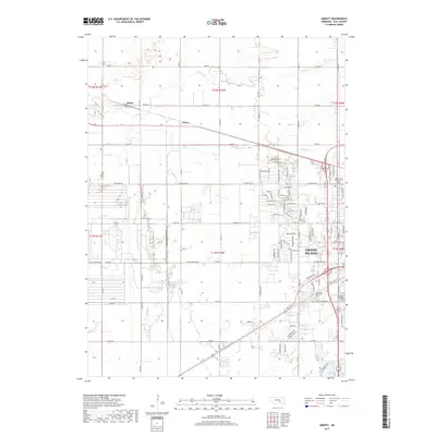
2017 Map of Abbott
USGS Topo · Published 2017About this map
Grand Island and the surrounding agricultural landscape are defined by the winding paths of Prairie Creek, Silver Creek, and Moores Creek in this 2017 study. The transition from rural Platte River valley bottomland to suburban development is evident as the city expands westward along thoroughfares like W Old Potash Hwy and W Capital Ave. Smaller, historically distinct locations such as Abbott and Ovina remain along the rail and road corridors to the northwest, maintaining their identity even as the urban footprint of the county seat grows closer. Genealogists will find the locations of several large local burial grounds clearly marked, including the Soldiers and Sailors Cem and Westlawn Memorial Cem, which serve as significant landmarks on the western edge of the community's modern residential grid.
Find a feature on this map
48 named features on this map. Tap any name to fly to it.
Don’t see what you’re looking for? This feature index may not catch every label — zoom into the map to look around manually.
Map Details
Editions of this 2017 Abbott Map
This is the sole edition of this map. No revisions or reprints were ever made.
Other maps of this area

1892 · Grand Island
USGS Topo · 1:62,500

1895 · Grand Island
USGS Topo · 1:62,500

1895 · Wood River
USGS Topo · 1:62,500

1896 · Wood River
USGS Topo · 1:125,000

1898 · Grand Island
USGS Topo · 1:125,000

1899 · Loup
USGS Topo · 1:125,000

1899 · St. Paul
USGS Topo · 1:125,000

1953 · Dannebrog
USGS Topo · 1:24,000

1955 · Broken Bow
USGS Topo · 1:250,000

1955 · Grand Island
USGS Topo · 1:250,000