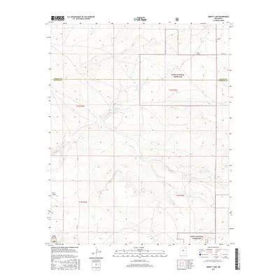
2017 Map of Abbott Lake
USGS Topo · Published 2017About this map
Kiowa National Grassland dominates this section of the High Plains, where the boundary between Colfax and Harding counties cuts across a landscape of canyons and seasonal watercourses. The geography is defined by the drainages of Salado Cr, Sauz Cr, and the deep incision of Alex Draw as they move through the arid terrain. For family historians, the presence of the Johnson Cem in the northeast corner provides a specific point of genealogical interest near the junction of Co RD C-37. The namesake Abbott Lake sits centrally, serving as a primary hydrological landmark in a region characterized by intermittent flows such as Arroyo Ojo Verde. From the elevations of Early Canyon to the breaks of Cañon Biscante, the map illustrates the transition from open grazing land to the rugged relief of the northern New Mexico plains.
Find a feature on this map
17 named features on this map. Tap any name to fly to it.
Don’t see what you’re looking for? This feature index may not catch every label — zoom into the map to look around manually.
Map Details
Editions of this 2017 Abbott Lake Map
This is the sole edition of this map. No revisions or reprints were ever made.
Other maps of this area

1954 · Raton
USGS Topo · 1:250,000

1958 · Raton
USGS Topo · 1:250,000

1965 · Taylor Springs
USGS Topo · 1:24,000

1965 · Abbott
USGS Topo · 1:24,000

1971 · Abbott Lake
USGS Topo · 1:24,000

1972 · Canon Colorado
USGS Topo · 1:24,000
1972 · Jaritas Ranch
USGS Topo · 1:24,000

1972 · Mills West
USGS Topo · 1:24,000
1974 · Mills East
USGS Topo · 1:24,000

1974 · Spear Hills
USGS Topo · 1:24,000