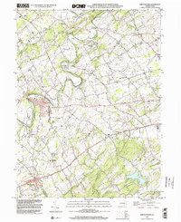
1999 Map of Abbottstown
USGS Topo · Published 2002About this map
Conewago Creek and Bermudian Creek wind through this landscape on the border of Adams and York counties, defining a region where colonial-era crossroads evolved into established boroughs. Abbottstown and East Berlin anchor the map, showing the dense settlement patterns typical of this part of Pennsylvania. The map highlights a strong religious and community infrastructure, evidenced by numerous historical sites like the Paradise Protectory and St Marys Ch, alongside several church-affiliated cemeteries such as Bermudian Ch Cem. To the south, the terrain rises into the Pigeon Hills, providing a sharp contrast to the developed corridors along the Lincoln Highway. The presence of the Adams County Fair Grounds and York Airport indicates the area's role as a regional hub for commerce and recreation at the close of the twentieth century.
Find a feature on this map
45 named features on this map. Tap any name to fly to it.
Don’t see what you’re looking for? This feature index may not catch every label — zoom into the map to look around manually.
Map Details
Editions of this 1999 Abbottstown Map
This is the sole edition of this map. No revisions or reprints were ever made.
Other maps of this area

1904 · Carlisle
USGS Topo · 1:62,500

1906 · New Cumberland
USGS Topo · 1:62,500

1908 · Gettysburg
USGS Topo · 1:62,500

1920 · Hanover
USGS Topo · 1:62,500

1922 · Hanover
USGS Topo · 1:62,500

1942 · Gettysburg
USGS Topo · 1:125,000

1943 · New Cumberland
USGS Topo · 1:62,500

1943 · Carlisle
USGS Topo · 1:62,500

1944 · Mc Sherrystown
USGS Topo · 1:31,680

1944 · Hampton
USGS Topo · 1:31,680