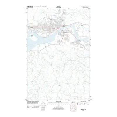
2011 Map of Aberdeen
USGS Topo · Published 2011About this map
Aberdeen and its residential expansions define the northern landscape of this 2011 survey, where the confluence of the Wishkah River and Chehalis River has long shaped the urban layout. The city's growth is reflected in various neighborhood developments such as Broadway Heights, Bel-Aire, and Pilgrim Heights, while industrial and logistical hubs like Junction City and Aberdeen Junction sit east of the main city center. Infrastructure such as the North Aberdeen Bridge and Chehalis River Bridge provide critical crossings for the local road network, including Pacific Ave and E Market St.
Find a feature on this map
87 named features on this map. Tap any name to fly to it.
Don’t see what you’re looking for? This feature index may not catch every label — zoom into the map to look around manually.
Map Details
Editions of this 2011 Aberdeen Map
This is the sole edition of this map. No revisions or reprints were ever made.
Other maps of this area

1940 · Montesano
USGS Topo · 1:62,500

1941 · Mobray
USGS Topo · 1:62,500

1943 · Humptulips
USGS Topo · 1:62,500

1943 · Mobray
USGS Topo · 1:62,500

1953 · Hoquiam
USGS Topo · 1:250,000

1955 · Montesano
USGS Topo · 1:62,500

1955 · Wynoochee Valley
USGS Topo · 1:62,500

1955 · Humptulips
USGS Topo · 1:62,500

1955 · Aberdeen SE
USGS Topo · 1:24,000

1956 · Western
USGS Topo · 1:24,000