
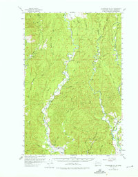
1955 Map of Wynoochee Valley
USGS Topo · Published 1957About this map
The Wynoochee River and its complex network of tributaries anchor this mid-century look at the timber-rich landscape of Grays Harbor County. Extensive industrial infrastructure defines the era, with the Middle Fork Railroad and various Logging Railroad spurs cutting through the drainages of the Satsop River system. The map documents a rugged working forest punctuated by fire-prevention landmarks like the McGray Lookout and another Lookout on Prices Peak.
Find a feature on this map
44 named features on this map. Tap any name to fly to it.
Don’t see what you’re looking for? This feature index may not catch every label — zoom into the map to look around manually.
Map Details
Editions of this 1955 Wynoochee Valley Map
3 editions found

Other maps of this area

1921 · Quinault Lake
USGS Topo · 1:62,500

1921 · Satsop
USGS Topo · 1:62,500

1940 · Montesano
USGS Topo · 1:62,500

1941 · Mobray
USGS Topo · 1:62,500

1941 · Ford
USGS Topo · 1:62,500

1943 · Humptulips
USGS Topo · 1:62,500

1943 · Nahwatzel Lake
USGS Topo · 1:62,500

1943 · Mobray
USGS Topo · 1:62,500

1953 · Hoquiam
USGS Topo · 1:250,000

1953 · Mt Tebo
USGS Topo · 1:62,500