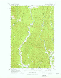
1955 Map of Wynoochee Valley
USGS Topo · Published 1975About this map
The Wynoochee River and its numerous tributaries dominate this 1950s landscape, illustrating the critical role of water management and timber extraction in western Washington. A Logging Railroad snakes through the eastern portion of the quadrangle, serving the industry alongside routes like Kelly Road and Matlock Road. The map documents early infrastructure such as a Pipeline, Tunnel, and a Siphon, while the Wynoochee Grange and a local Cem mark the community's social and historical footprint. Towards the south, Sylvia Lake State Park and Sylvia Lake offer a point of recreation amidst the working forest. Fire prevention and surveillance are evident through the presence of elevated vantage points at Prices Peak 730 Lookout and the McCray Lookout, while the Pumping Station and Gaging Sta near Geisler Creek reflect the area's active hydraulic monitoring.
Find a feature on this map
46 named features on this map. Tap any name to fly to it.
Don’t see what you’re looking for? This feature index may not catch every label — zoom into the map to look around manually.
Map Details
Editions of this 1955 Wynoochee Valley Map
3 editions found


Other maps of this area

1921 · Quinault Lake
USGS Topo · 1:62,500

1921 · Satsop
USGS Topo · 1:62,500

1940 · Montesano
USGS Topo · 1:62,500

1941 · Mobray
USGS Topo · 1:62,500

1941 · Ford
USGS Topo · 1:62,500

1943 · Humptulips
USGS Topo · 1:62,500

1943 · Nahwatzel Lake
USGS Topo · 1:62,500

1943 · Mobray
USGS Topo · 1:62,500

1953 · Hoquiam
USGS Topo · 1:250,000

1953 · Mt Tebo
USGS Topo · 1:62,500