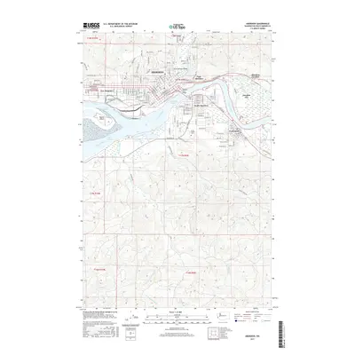
2017 Map of Aberdeen
USGS Topo · Published 2017About this map
Aberdeen sits at the critical confluence of the Wishkah River and the Chehalis River, serving as a central hub for the Grays Harbor region. This survey captures the complex industrial and maritime footprint of the waterfront, from the Cosmopolis Waterway and Aberdeen Reach to the shipping facilities along Port Industrial Rd. The city's northern expansion is marked by residential developments near Fern Hill Cem, while the educational influence of Grays Harbor Coll anchors the southern heights. Moving away from the urban grid of South Aberdeen and Cosmopolis, the landscape shifts into the timbered drainages of Charley Creek and Newskah Creek. The map provides a detailed view of the infrastructure supporting the local economy, including the North Aberdeen Bridge and the rail connections at Aberdeen Junction, which link these port towns to the interior.
Find a feature on this map
92 named features on this map. Tap any name to fly to it.
Don’t see what you’re looking for? This feature index may not catch every label — zoom into the map to look around manually.
Map Details
Editions of this 2017 Aberdeen Map
This is the sole edition of this map. No revisions or reprints were ever made.
Other maps of this area

1940 · Montesano
USGS Topo · 1:62,500

1941 · Mobray
USGS Topo · 1:62,500

1943 · Humptulips
USGS Topo · 1:62,500

1943 · Mobray
USGS Topo · 1:62,500

1953 · Hoquiam
USGS Topo · 1:250,000

1955 · Montesano
USGS Topo · 1:62,500

1955 · Wynoochee Valley
USGS Topo · 1:62,500

1955 · Humptulips
USGS Topo · 1:62,500

1955 · Aberdeen SE
USGS Topo · 1:24,000

1956 · Western
USGS Topo · 1:24,000