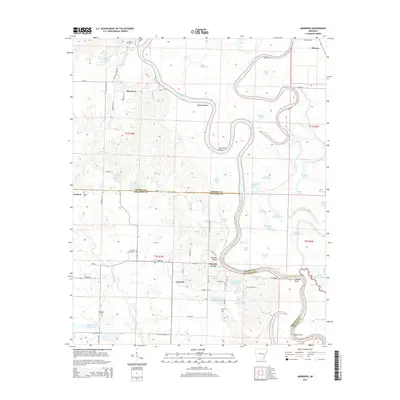
2014 Map of Aberdeen
USGS Topo · Published 2014About this map
The White River carves a dramatic, winding course across the boundary of Monroe and Arkansas counties, defining the character of this riverine landscape. The river creates massive oxbows and landforms like Hurricane Bend and Coahoma Point, while numerous backwater lakes such as Big Eagle Lake and Goose Lakes fill the floodplains. Settlement is scattered, anchored by the community of Aberdeen in the north and Casscoe to the south. Historically significant landmarks include Preston Ferry, which provided river crossing near Preston Bluff. The map is particularly useful for genealogical research, showing a high density of rural burial grounds including Roc Roe Cem, Hunters Chapel Cem, and Mt Pisgah Cem. Small rural roads and lanes, many named for local families like McDonald Ln and Hogan-Dickson Ln, connect these dispersed settlements through the lowlands.
Find a feature on this map
89 named features on this map. Tap any name to fly to it.
Don’t see what you’re looking for? This feature index may not catch every label — zoom into the map to look around manually.
Map Details
Editions of this 2014 Aberdeen Map
This is the sole edition of this map. No revisions or reprints were ever made.
Other maps of this area

1935 · Clarendon
USGS Topo · 1:62,500

1939 · Indian Bay
USGS Topo · 1:62,500

1940 · Holly Grove
USGS Topo · 1:62,500

1941 · De Witt
USGS Topo · 1:62,500

1941 · Clarendon
USGS Topo · 1:62,500

1948 · Helena
USGS Topo · 1:250,000

1950 · Helena
USGS Topo · 1:250,000

1954 · Indian Bay
USGS Topo · 1:62,500

1954 · De Witt
USGS Topo · 1:62,500

1955 · Helena
USGS Topo · 1:250,000