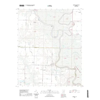
2020 Map of Aberdeen
USGS Topo · Published 2020About this map
The White River winds through a dense landscape of oxbow lakes and wetlands on the border of Monroe and Arkansas counties. This riverine environment is defined by its complex hydrology, featuring numerous named bodies of water such as Hurricane Bend, Eagle Nest Lake, and the series of Payer Lakes. Human activity is concentrated along the terrace edges and bluffs, notably at Aberdeen and Casscoe, where the higher ground provides relief from the floodplain.
Find a feature on this map
81 named features on this map. Tap any name to fly to it.
Don’t see what you’re looking for? This feature index may not catch every label — zoom into the map to look around manually.
Map Details
Editions of this 2020 Aberdeen Map
This is the sole edition of this map. No revisions or reprints were ever made.
Other maps of this area

1935 · Clarendon
USGS Topo · 1:62,500

1939 · Indian Bay
USGS Topo · 1:62,500

1940 · Holly Grove
USGS Topo · 1:62,500

1941 · De Witt
USGS Topo · 1:62,500

1941 · Clarendon
USGS Topo · 1:62,500

1948 · Helena
USGS Topo · 1:250,000

1950 · Helena
USGS Topo · 1:250,000

1954 · Indian Bay
USGS Topo · 1:62,500

1954 · De Witt
USGS Topo · 1:62,500

1955 · Helena
USGS Topo · 1:250,000