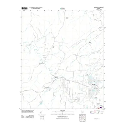
2011 Map of Abernant
USGS Topo · Published 2011About this map
Abernant serves as a central hub in this section of Tuscaloosa County, where the topography is defined by the significant rise of Cely Ann Mountain and the long stretch of Griffin Ridge. The landscape is intricately carved by Davis Creek, Rockcastle Creek, and Mud Creek, which feed into an extensive system of residential and recreational waters. The southern portion of the map reveals a high concentration of man-made water bodies, including Million Dollar Lake, Lake Number Seven, and Lake Retreat, reflecting a shift toward lakeside community development. Genealogists and local historians can locate several long-standing burial sites such as Liberty Cemetery and Davis Creek Cemetery. Small settlements like Pattersontown, Yolande, and Rickey are linked by a network of winding rural roads, such as Hogsick Creek Rd and Sumter Rd, tracing the legacy of earlier industrial and residential patterns in the Alabama coal region.
Find a feature on this map
119 named features on this map. Tap any name to fly to it.
Don’t see what you’re looking for? This feature index may not catch every label — zoom into the map to look around manually.
Map Details
Editions of this 2011 Abernant Map
This is the sole edition of this map. No revisions or reprints were ever made.
Other maps of this area

1899 · Brookwood
USGS Topo · 1:125,000

1927 · Adger
USGS Topo · 1:48,000

1929 · Searles
USGS Topo · 1:48,000

1931 · Cottondale
USGS Topo · 1:48,000

1932 · Yolande
USGS Topo · 1:62,500

1934 · Searles
USGS Topo · 1:62,500

1934 · Cottondale
USGS Topo · 1:62,500

1934 · Blocton
USGS Topo · 1:48,000

1935 · Yolande
USGS Topo · 1:62,500

1940 · Blocton
USGS Topo · 1:62,500