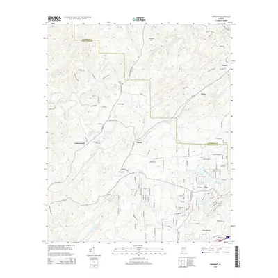
2014 Map of Abernant
USGS Topo · Published 2014About this map
The hills and hollows of the Jefferson Co and Tuscaloosa Co border region are defined by a complex network of creeks and small-scale settlements. Historically significant landmarks such as Liberty Church and the adjacent Liberty Cem sit near the crossing of Hannah Creek and the southern slopes of Cely Ann Mtn. The landscape is notably dotted with numerous small lakes and reservoirs, including the residential cluster around Million Dollar Lake and the nearby Lake View. Local history is anchored by early communities like Pattersontown and Yolande, which developed along the winding corridors of Al-216 and the banks of Davis Creek. The topography transitions from the high points of Griffin Ridge down to the southern residential expansions near Woodstock and Rickey, reflecting a shift from rural timber and mining terrain to mid-century suburban lake developments.
Find a feature on this map
130 named features on this map. Tap any name to fly to it.
Don’t see what you’re looking for? This feature index may not catch every label — zoom into the map to look around manually.
Map Details
Editions of this 2014 Abernant Map
This is the sole edition of this map. No revisions or reprints were ever made.
Other maps of this area

1899 · Brookwood
USGS Topo · 1:125,000

1927 · Adger
USGS Topo · 1:48,000

1929 · Searles
USGS Topo · 1:48,000

1931 · Cottondale
USGS Topo · 1:48,000

1932 · Yolande
USGS Topo · 1:62,500

1934 · Searles
USGS Topo · 1:62,500

1934 · Cottondale
USGS Topo · 1:62,500

1934 · Blocton
USGS Topo · 1:48,000

1935 · Yolande
USGS Topo · 1:62,500

1940 · Blocton
USGS Topo · 1:62,500