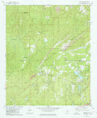
1980 Map of Abernant
USGS Topo · Published 1980About this map
Abernant and Yolande sit at the center of this industrial and residential landscape during the 1970s. The region is defined by a heavy extractive economy, with extensive Strip Mines and the Shannon Mine following the coal-bearing ridges between Cely Ann Mountain and Rock Mountain. This industrial presence contrasts with the residential development at Million Dollar Lake Estates and Lakeview, where several recreational waters including Ski Lake and Catfish Lake were established near the Jefferson and Tuscaloosa county line. Transport in the area is anchored by the Louisville and Nashville railroad, which weaves through the topography alongside Davis Creek. Traditional community life remains visible through numerous rural landmarks such as Liberty Ch, Hephzibah Ch, and Krisstown, reflecting a mix of older mining settlements and newer mid-century subdivisions.
Find a feature on this map
47 named features on this map. Tap any name to fly to it.
Don’t see what you’re looking for? This feature index may not catch every label — zoom into the map to look around manually.
Map Details
Editions of this 1980 Abernant Map
This is the sole edition of this map. No revisions or reprints were ever made.
Other maps of this area

1899 · Brookwood
USGS Topo · 1:125,000

1927 · Adger
USGS Topo · 1:48,000

1929 · Searles
USGS Topo · 1:48,000

1931 · Cottondale
USGS Topo · 1:48,000

1932 · Yolande
USGS Topo · 1:62,500

1934 · Searles
USGS Topo · 1:62,500

1934 · Cottondale
USGS Topo · 1:62,500

1934 · Blocton
USGS Topo · 1:48,000

1935 · Yolande
USGS Topo · 1:62,500

1940 · Blocton
USGS Topo · 1:62,500