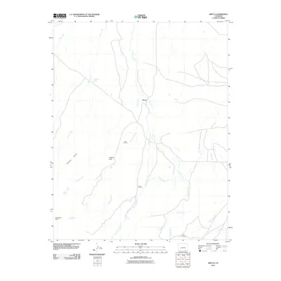
2010 Map of Abeyta
USGS Topo · Published 2010About this map
The high desert landscape of Las Animas County is defined by a network of seasonal watercourses and historic irrigation systems in this 2010 survey. Irrigation infrastructure like the Hollenbeck Ditch, Quintanilla Ditch, and Mestas Ditch reveal the agricultural heritage of the region, where water management is vital. The small settlement of Abeyta is surrounded by significant family landmarks, including the Tapia Cemetery, Lucero Cemetery, and Leyba Cemetery, which provide essential clues for genealogists researching the Hispanic families of southern Colorado. The terrain is marked by prominent landforms such as McBride Butte and Horseshoe Mesa, while water sources like Cordova Lake and Juan Abeyta Spring signify the few reliable points of moisture in a land of arroyos. This map captures the intersection of traditional land use and the persistent hydrology of the high plains.
Find a feature on this map
24 named features on this map. Tap any name to fly to it.
Don’t see what you’re looking for? This feature index may not catch every label — zoom into the map to look around manually.
Map Details
Editions of this 2010 Abeyta Map
This is the sole edition of this map. No revisions or reprints were ever made.
Other maps of this area

1892 · Elmoro
USGS Topo · 1:125,000

1893 · Elmoro
USGS Topo · 1:125,000

1897 · Elmoro
USGS Topo · 1:125,000

1912 · Raton
USGS Topo · 1:62,500

1914 · Raton
USGS Topo · 1:62,500

1954 · Raton
USGS Topo · 1:250,000

1954 · Trinidad
USGS Topo · 1:250,000

1955 · Trinidad
USGS Topo · 1:250,000

1958 · Raton
USGS Topo · 1:250,000

1958 · Trinidad
USGS Topo · 1:250,000