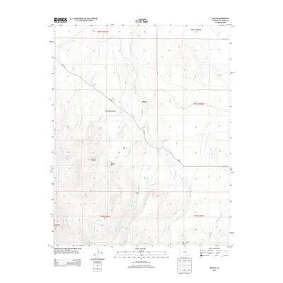
2013 Map of Abeyta
USGS Topo · Published 2013About this map
Abeyta serves as the focal point for this high-plains landscape, where the drainage systems of San Isidro Cr and Sauce Arroyo define the local topography. This arid region is marked by an extensive network of traditional irrigation infrastructure, including the Hollenbeck Ditch, Quintanilla Ditch, and Mestas Ditch, reflecting the critical importance of water management in Las Animas County. For those researching local lineages, the map identifies several family-named burial grounds such as Tapia Cem, Lucero Cem, and Leyba Cem. To the west, the terrain rises into the distinct landforms of McBride Butte and the Cañoncito Romero canyon, while the southern reaches feature Horseshoe Mesa and the Juan Abeyta Spring. This 2013 survey provides a clear view of the rural road network, notably Co RD 105.5, which connects these scattered agricultural and historic sites.
Find a feature on this map
37 named features on this map. Tap any name to fly to it.
Don’t see what you’re looking for? This feature index may not catch every label — zoom into the map to look around manually.
Map Details
Editions of this 2013 Abeyta Map
This is the sole edition of this map. No revisions or reprints were ever made.
Other maps of this area

1892 · Elmoro
USGS Topo · 1:125,000

1893 · Elmoro
USGS Topo · 1:125,000

1897 · Elmoro
USGS Topo · 1:125,000

1912 · Raton
USGS Topo · 1:62,500

1914 · Raton
USGS Topo · 1:62,500

1954 · Raton
USGS Topo · 1:250,000

1954 · Trinidad
USGS Topo · 1:250,000

1955 · Trinidad
USGS Topo · 1:250,000

1958 · Raton
USGS Topo · 1:250,000

1958 · Trinidad
USGS Topo · 1:250,000