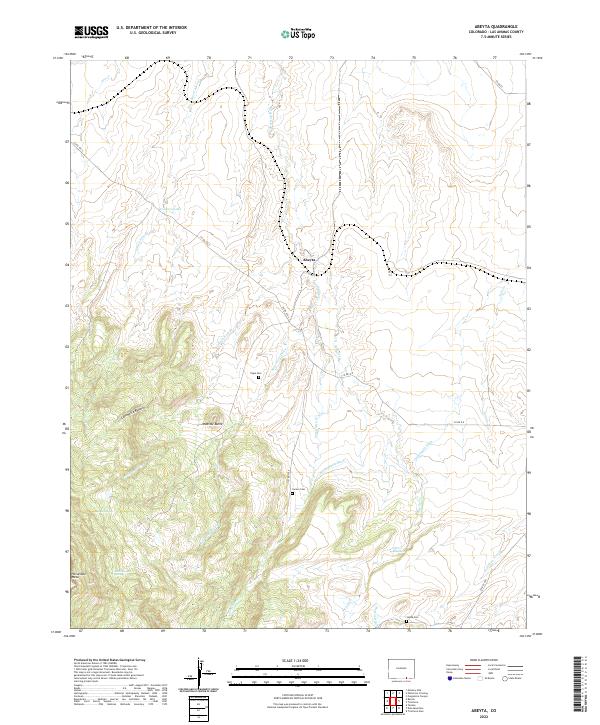
2022 Map of Abeyta
USGS Topo · Published 2022About this map
The settlement of Abeyta sits at the heart of this high-altitude landscape in Las Animas County, where the transition from flat arroyos to prominent mesas defines the local geography. Family history is etched into the terrain through various landmarks, including Juan Abeyta Spring and several burial grounds such as Tapia Cem, Lucero Cem, and Leyba Cem. These sites, along with names like Cordova Lake, suggest a deep-rooted lineage of land use and habitation in this part of southern Colorado.
Find a feature on this map
34 named features on this map. Tap any name to fly to it.
Don’t see what you’re looking for? This feature index may not catch every label — zoom into the map to look around manually.
Map Details
Editions of this 2022 Abeyta Map
This is the sole edition of this map. No revisions or reprints were ever made.
Other maps of this area

1892 · Elmoro
USGS Topo · 1:125,000

1893 · Elmoro
USGS Topo · 1:125,000

1897 · Elmoro
USGS Topo · 1:125,000

1912 · Raton
USGS Topo · 1:62,500

1914 · Raton
USGS Topo · 1:62,500

1954 · Raton
USGS Topo · 1:250,000

1954 · Trinidad
USGS Topo · 1:250,000

1955 · Trinidad
USGS Topo · 1:250,000

1958 · Raton
USGS Topo · 1:250,000

1958 · Trinidad
USGS Topo · 1:250,000