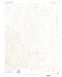
1971 Map of Abeyta
USGS Topo · Published 1974About this map
The settlement of Abeyta is centered within a landscape defined by an intricate network of irrigation ditches and seasonal watercourses in Las Animas County. In the early 1970s, the local agricultural economy relied on the Hollenbeck Ditch, Quintanilla Ditch, and Mestas Ditch to manage water across the arid terrain. The presence of several family-named burial grounds, including Tapia Cem, Lucero Cem, and Leyba Cem, speaks to the deep-rooted Hispanic heritage and generational ranching history of this high-plains region.
Find a feature on this map
32 named features on this map. Tap any name to fly to it.
Don’t see what you’re looking for? This feature index may not catch every label — zoom into the map to look around manually.
Map Details
Editions of this 1971 Abeyta Map
This is the sole edition of this map. No revisions or reprints were ever made.
Other maps of this area

1892 · Elmoro
USGS Topo · 1:125,000

1893 · Elmoro
USGS Topo · 1:125,000

1897 · Elmoro
USGS Topo · 1:125,000

1912 · Raton
USGS Topo · 1:62,500

1914 · Raton
USGS Topo · 1:62,500

1954 · Raton
USGS Topo · 1:250,000

1954 · Trinidad
USGS Topo · 1:250,000

1955 · Trinidad
USGS Topo · 1:250,000

1958 · Raton
USGS Topo · 1:250,000

1958 · Trinidad
USGS Topo · 1:250,000