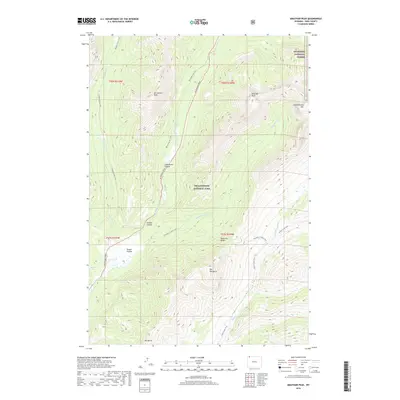
2018 Map of Abiathar Peak
USGS Topo · Published 2018About this map
Yellowstone National Park dominates this high-altitude landscape in the northeast corner of the park, where the Absaroka Range creates a formidable skyline of jagged peaks and deep-cut canyons. The NE Entrance Road follows the natural corridor of Soda Butte Cr, providing the primary human access point through Soda Butte Canyon. This transit route passes through Round Prairie, a significant break in the vertical terrain near Ice Box Canyon. High above the valley floor, named summits like Abiathar Peak, Barronette Peak, and the prominently named The Thunderer define the wilderness character of the region. The map also captures the boundary where the park meets the Shoshone National Forest, illustrating the transition between different federal land protections. A network of backcountry routes, including the Thunderer Cutoff Trail and Barronette Ski Trail, crisscross the ridges and valleys.
Find a feature on this map
27 named features on this map. Tap any name to fly to it.
Don’t see what you’re looking for? This feature index may not catch every label — zoom into the map to look around manually.
Map Details
Editions of this 2018 Abiathar Peak Map
This is the sole edition of this map. No revisions or reprints were ever made.
Other maps of this area

1886 · Canyon
USGS Topo · 1:125,000

1891 · Livingston
USGS Topo · 1:250,000

1893 · Livingston
USGS Topo · 1:250,000

1895 · Canyon
USGS Topo · 1:125,000

1896 · Canyon
USGS Topo · 1:125,000

1896 · Crandall Creek
USGS Topo · 1:125,000

1898 · Granite Mountain District
USGS Topo · 1:125,000

1899 · Crandall
USGS Topo · 1:125,000

1901 · Canyon
USGS Topo · 1:125,000

1907 · Canyon
USGS Topo · 1:125,000