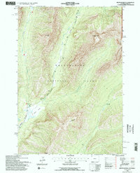
1991 Map of Abiathar Peak
USGS Topo · Published 1996About this map
Yellowstone National Park dominates this high-altitude landscape where the Northeast Entrance Road winds through the glacially carved valleys of the northern Absaroka Range. The confluence of Soda Butte Creek and Pebble Creek near the Round Prairie area illustrates a classic mountain drainage pattern, flanked by the massive walls of Barronette Peak and Abiathar Peak. This region, surveyed in the early 1990s, reveals a terrain defined by steep vertical relief and secluded canyons like Icebox Canyon. A single point of backcountry human infrastructure, the Cache Creek Patrol Cabin, sits along Cache Creek beneath the shadows of The Thunderer and Amphitheater Mountain, serving as a remote outpost in one of the park's most geologically dramatic corners.
Find a feature on this map
26 named features on this map. Tap any name to fly to it.
Don’t see what you’re looking for? This feature index may not catch every label — zoom into the map to look around manually.
Map Details
Editions of this 1991 Abiathar Peak Map
This is the sole edition of this map. No revisions or reprints were ever made.
Other maps of this area

1886 · Canyon
USGS Topo · 1:125,000

1891 · Livingston
USGS Topo · 1:250,000

1893 · Livingston
USGS Topo · 1:250,000

1895 · Canyon
USGS Topo · 1:125,000

1896 · Canyon
USGS Topo · 1:125,000

1896 · Crandall Creek
USGS Topo · 1:125,000

1898 · Granite Mountain District
USGS Topo · 1:125,000

1899 · Crandall
USGS Topo · 1:125,000

1901 · Canyon
USGS Topo · 1:125,000

1907 · Canyon
USGS Topo · 1:125,000