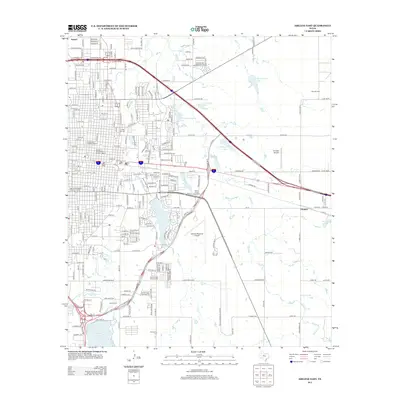
2012 Map of Abilene East
USGS Topo · Published 2012About this map
Abilene Commercial Historic District and the Parramore Historic District anchor the urban core of this West Texas hub, illustrating its early twentieth-century growth and civic organization. This 2012 survey details the educational and medical infrastructure that defines the local landscape, from Hardin-Simmons Univ and Abilene Christian Univ to the grounds of the Abilene State Hospital Cem. The eastern outskirts transition into a network of small reservoirs, including Lytle Lake and Kirby Lake, alongside specialized land uses like the West Texas Fairground and the Abilene Regional Airport.
Find a feature on this map
47 named features on this map. Tap any name to fly to it.
Don’t see what you’re looking for? This feature index may not catch every label — zoom into the map to look around manually.
Map Details
Editions of this 2012 Abilene East Map
This is the sole edition of this map. No revisions or reprints were ever made.
Other maps of this area

1890 · Abilene
USGS Topo · 1:125,000

1891 · Anson
USGS Topo · 1:125,000

1892 · Abilene
USGS Topo · 1:125,000

1893 · Anson
USGS Topo · 1:125,000

1954 · Abilene
USGS Topo · 1:250,000

1957 · Hawley
USGS Topo · 1:62,500

1957 · Kirby Lake
USGS Topo · 1:62,500

1957 · Abilene West
USGS Topo · 1:24,000

1957 · Abilene East
USGS Topo · 1:24,000

1957 · Nugent
USGS Topo · 1:62,500