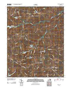
2010 Map of Abilene
USGS Topo · Published 2010About this map
Abilene and County Line Cross Roads anchor this rural landscape in Charlotte County during the early 21st century. The map reveals a complex water management system along the Buffalo Creek drainage, characterized by a series of numbered dams such as Buffalo Creek Number Five Dam and Buffalo Creek Number Nine Dam. These structures have created several significant local reservoirs, including Stockton Lake, Bell Lake, and Lake Gayle, which define the hydrography of the region alongside natural courses like Roanoke Creek and Spring Creek.
Find a feature on this map
54 named features on this map. Tap any name to fly to it.
Don’t see what you’re looking for? This feature index may not catch every label — zoom into the map to look around manually.
Map Details
Editions of this 2010 Abilene Map
This is the sole edition of this map. No revisions or reprints were ever made.
Other maps of this area

1891 · Farmville
USGS Topo · 1:125,000

1892 · Appomattox
USGS Topo · 1:125,000

1893 · Farmville
USGS Topo · 1:125,000

1947 · Roanoke
USGS Topo · 1:250,000

1956 · Charlotte Court House
USGS Topo · 1:62,500

1958 · Farmville
USGS Topo · 1:62,500

1958 · Keysville
USGS Topo · 1:62,500

1958 · Pamplin City
USGS Topo · 1:62,500

1959 · Roanoke
USGS Topo · 1:250,000

1963 · Roanoke
USGS Topo · 1:250,000