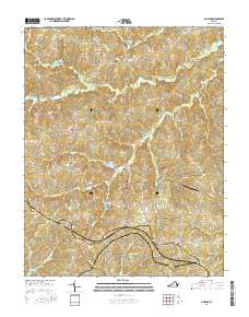
2016 Map of Abilene
USGS Topo · Published 2016About this map
Abilene and County Line Cross Roads serve as the central hubs for this rural landscape along the boundary of Charlotte and Prince Edward Counties. The terrain is defined by a dense network of minor tributaries, including Buffalo Cr and Spring Cr, which feed into the larger Roanoke Cr. This 2016 survey illustrates a community deeply rooted in its local history, evidenced by numerous family and community burial grounds such as Bethpeor Cem, Saint Ann Cem, and Buffalo Cem. The presence of the Abilene Airport and roads like Darlington Heights Rd suggest a modern layer of connectivity superimposed over a long-established agricultural grid. Small settlements like Five Forks and Darlington Heights maintain their identity through this web of county routes, where the land's hydrology dictates the placement of homes and crossings.
Find a feature on this map
65 named features on this map. Tap any name to fly to it.
Don’t see what you’re looking for? This feature index may not catch every label — zoom into the map to look around manually.
Map Details
Editions of this 2016 Abilene Map
This is the sole edition of this map. No revisions or reprints were ever made.
Other maps of this area

1891 · Farmville
USGS Topo · 1:125,000

1892 · Appomattox
USGS Topo · 1:125,000

1893 · Farmville
USGS Topo · 1:125,000

1947 · Roanoke
USGS Topo · 1:250,000

1956 · Charlotte Court House
USGS Topo · 1:62,500

1958 · Farmville
USGS Topo · 1:62,500

1958 · Keysville
USGS Topo · 1:62,500

1958 · Pamplin City
USGS Topo · 1:62,500

1959 · Roanoke
USGS Topo · 1:250,000

1963 · Roanoke
USGS Topo · 1:250,000