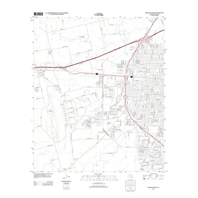
2012 Map of Abilene West
USGS Topo · Published 2012About this map
Dyess Air Force Base dominates the western landscape of this Taylor County region, illustrating the significant military footprint on the outskirts of Tye. The area is characterized by a dense network of suburban developments and essential institutions, including the campus of McMurry Univ and local landmarks like Blue Sox Stadium. A series of creeks, including Little Elm Cr, Indian Cr, and Cat Claw Cr, navigate the terrain, often intersecting with major transit corridors like W Overland Trl and Arnold Blvd. Smaller aviation and community sites, such as the Flying B Ranch Airstrip and the Little Elm Cem, provide specific points of interest for genealogists and local historians tracking the growth of West Texas at the start of the 2010s. The presence of Truitt Davis Lake and Elmwood Memorial Park further defines the recreational and civic character of the Abilene periphery.
Find a feature on this map
266 named features on this map. Tap any name to fly to it.
Don’t see what you’re looking for? This feature index may not catch every label — zoom into the map to look around manually.
Map Details
Editions of this 2012 Abilene West Map
This is the sole edition of this map. No revisions or reprints were ever made.
Other maps of this area

1890 · Abilene
USGS Topo · 1:125,000

1891 · Anson
USGS Topo · 1:125,000

1892 · Abilene
USGS Topo · 1:125,000

1893 · Anson
USGS Topo · 1:125,000

1954 · Abilene
USGS Topo · 1:250,000

1957 · Hawley
USGS Topo · 1:62,500

1957 · Kirby Lake
USGS Topo · 1:62,500

1957 · Abilene West
USGS Topo · 1:24,000

1957 · Abilene East
USGS Topo · 1:24,000

1957 · Nugent
USGS Topo · 1:62,500