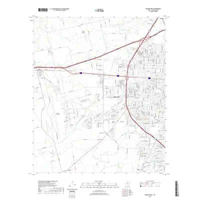
2019 Map of Abilene West
USGS Topo · Published 2019About this map
Dyess Air Force Base dominates the western landscape of this Taylor County region, showcasing the sprawling layout of the military installation alongside the western reaches of Abilene. The map illustrates a transitional geography where the dense grid of city streets meets the surrounding prairie and suburban fringes of Tye, Caps, and Wylie. This modern survey reveals the intricate road network supporting the region's growth, from major transit corridors like the I-20 Service Road to local thoroughfares like Old Anson Rd.
Find a feature on this map
201 named features on this map. Tap any name to fly to it.
Don’t see what you’re looking for? This feature index may not catch every label — zoom into the map to look around manually.
Map Details
Editions of this 2019 Abilene West Map
This is the sole edition of this map. No revisions or reprints were ever made.
Other maps of this area

1890 · Abilene
USGS Topo · 1:125,000

1891 · Anson
USGS Topo · 1:125,000

1892 · Abilene
USGS Topo · 1:125,000

1893 · Anson
USGS Topo · 1:125,000

1954 · Abilene
USGS Topo · 1:250,000

1957 · Hawley
USGS Topo · 1:62,500

1957 · Kirby Lake
USGS Topo · 1:62,500

1957 · Abilene West
USGS Topo · 1:24,000

1957 · Abilene East
USGS Topo · 1:24,000

1957 · Nugent
USGS Topo · 1:62,500