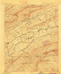
1894 Map of Abingdon
USGS Topo · Published 1901About this map
Abingdon serves as a primary hub in this late 19th-century survey of Southwest Virginia, where the Norfolk and Western R. R. cuts a path through the Great Valley. This corridor connects critical local industry and education, from the salt works at Saltville and the gypsum resources near Plasterburg to the campus of Emory and Henry College. The landscape is defined by the parallel ridges of the Clinch Mountains and Walker Mountain, with the complex drainage of the Middle Fork and South Fork Holston River supporting numerous milling operations such as Belfast Mills, Holstein Mill, and Vance's Mill. In the south, the topography rises sharply toward the high peaks of White Top and Mt. Rogers, marking the rugged borderlands near the Virginia Tennessee State Boundary.
Find a feature on this map
132 named features on this map. Tap any name to fly to it.
Don’t see what you’re looking for? This feature index may not catch every label — zoom into the map to look around manually.
Map Details
Editions of this 1894 Abingdon Map
5 editions found

Other maps of this area

1886 · Grundy
USGS Topo · 1:125,000

1887 · Pocahontas
USGS Topo · 1:125,000

1889 · Wytheville
USGS Topo · 1:125,000

1889 · Wilkesboro
USGS Topo · 1:125,000

1890 · Grundy
USGS Topo · 1:125,000

1891 · Tazewell
USGS Topo · 1:125,000

1891 · Pocahontas
USGS Topo · 1:125,000

1891 · Roan Mountain
USGS Topo · 1:125,000

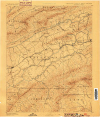
1891 · Abingdon
USGS Topo · 1:125,000

1891 · Wilkesboro
USGS Topo · 1:125,000