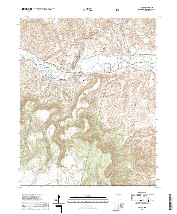
2023 Map of Abiquiu
USGS Topo · Published 2023About this map
The Rio Chama corridor defines this northern New Mexico landscape, where agricultural lifeways are supported by historic water systems like the Abiquiu Ditch and Rancho Abiquiu Ditch. Small, distinct settlements such as Abiquiu, Barranca, and Buena Vista are situated between the river's path and the rising elevations of Lobato Mesa and Mesa de Abiquiu. To the south, the terrain transitions into the protected lands of the Santa Fe National Forest, while the north is bounded by the Carson National Forest. Local history is anchored by sites like the Abiquiu Catholic Cem and family-named features like La Loma de Arena and Cerrito Blanco. These landmarks, along with a complex network of arroyos including Arroyo del Cobre and Arroyo Seco, illustrate a high-desert environment shaped by both geological forces and long-standing human irrigation practices.
Find a feature on this map
49 named features on this map. Tap any name to fly to it.
Don’t see what you’re looking for? This feature index may not catch every label — zoom into the map to look around manually.
Map Details
Editions of this 2023 Abiquiu Map
This is the sole edition of this map. No revisions or reprints were ever made.
Other maps of this area

1918 · Abiquiu
USGS Topo · 1:125,000

1953 · Canones
USGS Topo · 1:24,000

1953 · Chili
USGS Topo · 1:24,000

1953 · Abiquiu
USGS Topo · 1:24,000

1953 · Medanales
USGS Topo · 1:24,000

1953 · Vallecitos
USGS Topo · 1:24,000

1953 · Polvadera Peak
USGS Topo · 1:24,000

1953 · El Rito
USGS Topo · 1:24,000

1953 · Canjilon SE
USGS Topo · 1:24,000

1953 · Ghost Ranch
USGS Topo · 1:24,000